In this guide
Ilha Grande is a hiking island whether or not you came to hike. With no cars and no coast road, walking is simply how you get to most of the good places — the wild ocean beaches, the high viewpoints, the old prison village on the far side. The island has well over a hundred kilometres of marked forest trail, and you can spend a lazy hour on the easiest of them or a punishing seven on the hardest. Either way, the walking is half the pleasure of the place: shaded paths through dense Atlantic forest, alive with birdsong and the occasional bark of a howler monkey, opening now and then onto a beach or a view that stops you dead.
It's also the part of an Ilha Grande trip that people most often underestimate, and that's where this guide comes in. The heat here is real, the forest goes dark earlier than you'd think under the canopy, the ground gets genuinely slippery, and people do lose the path. None of that should put you off — it should just make you plan a little. Below I've laid out how the trail system works, the classic routes with honest times and difficulty, the case for a guide, and the safety and packing notes that actually matter on this island.
If you're still working out the basics of getting to and staying on the island, read the complete Ilha Grande guide alongside this one — it covers the crossings, the village and the boats. This piece is for once you're on the ground with your boots on.
How the trail network works
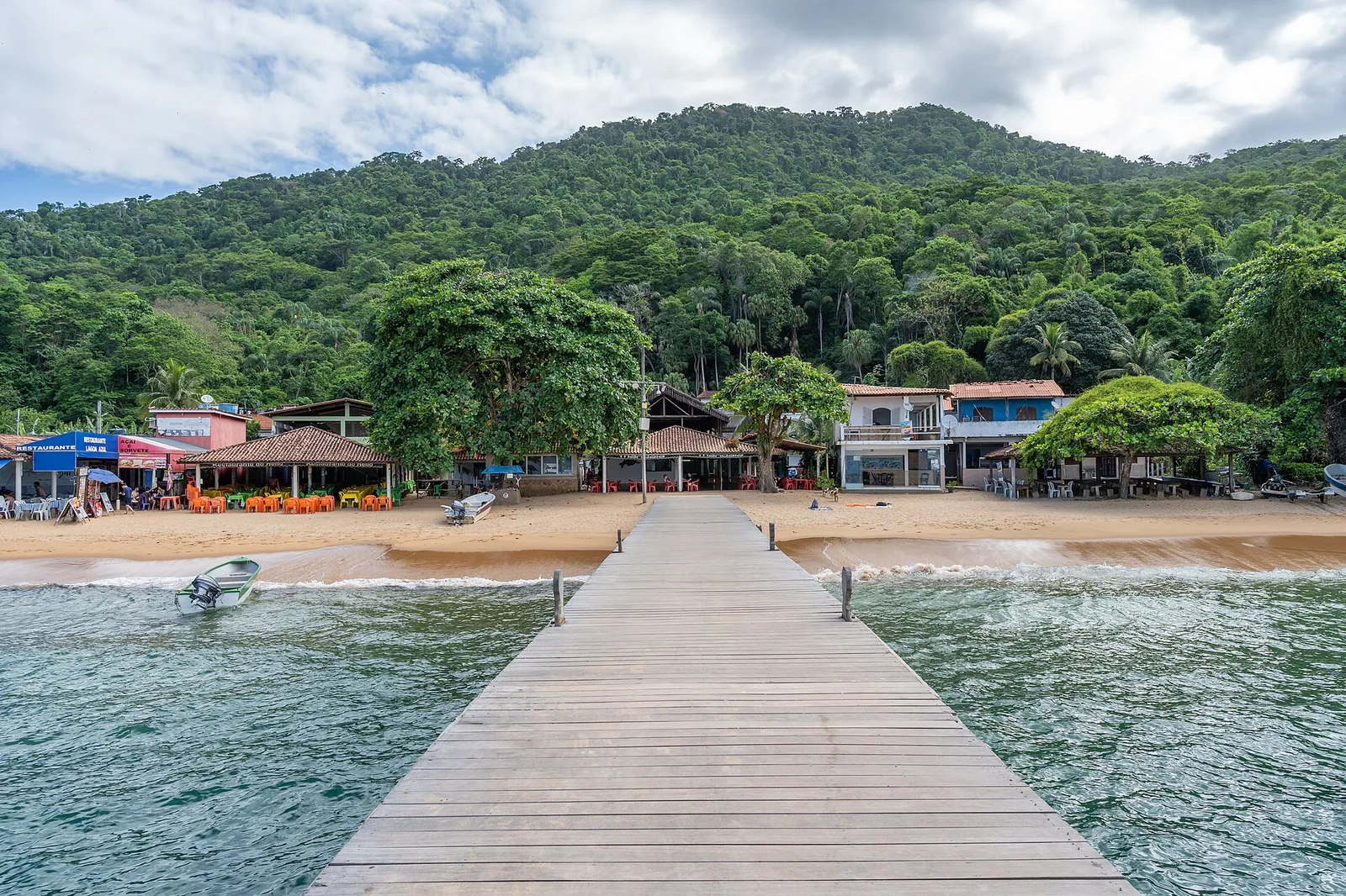
Ilha Grande's trails use a clear, friendly system: every marked route is given a code of "T" plus a number — T1, T2, T10, T13, T14 and so on — signed at the trailheads and the main junctions. The numbers don't run in geographic order, so don't try to read logic into them; just match the T-number to the route you've chosen. The network fans out from Vila do Abraão, the only real village, linking it to the nearer beaches, the viewpoints, the high peaks and the historic sites across the island.
The signing is decent but not flawless. Posts go missing, paint fades, and at a few unmarked forks it's easy to take the wrong branch. So treat the T-signs as the primary guide and carry a backup: an offline trail map on your phone is the simplest insurance, and many of the routes are mapped on the usual hiking apps. Tell your pousada which trail you're doing and roughly when you expect to be back — it's a small village and people look out for each other, but only if someone knows you're out there.
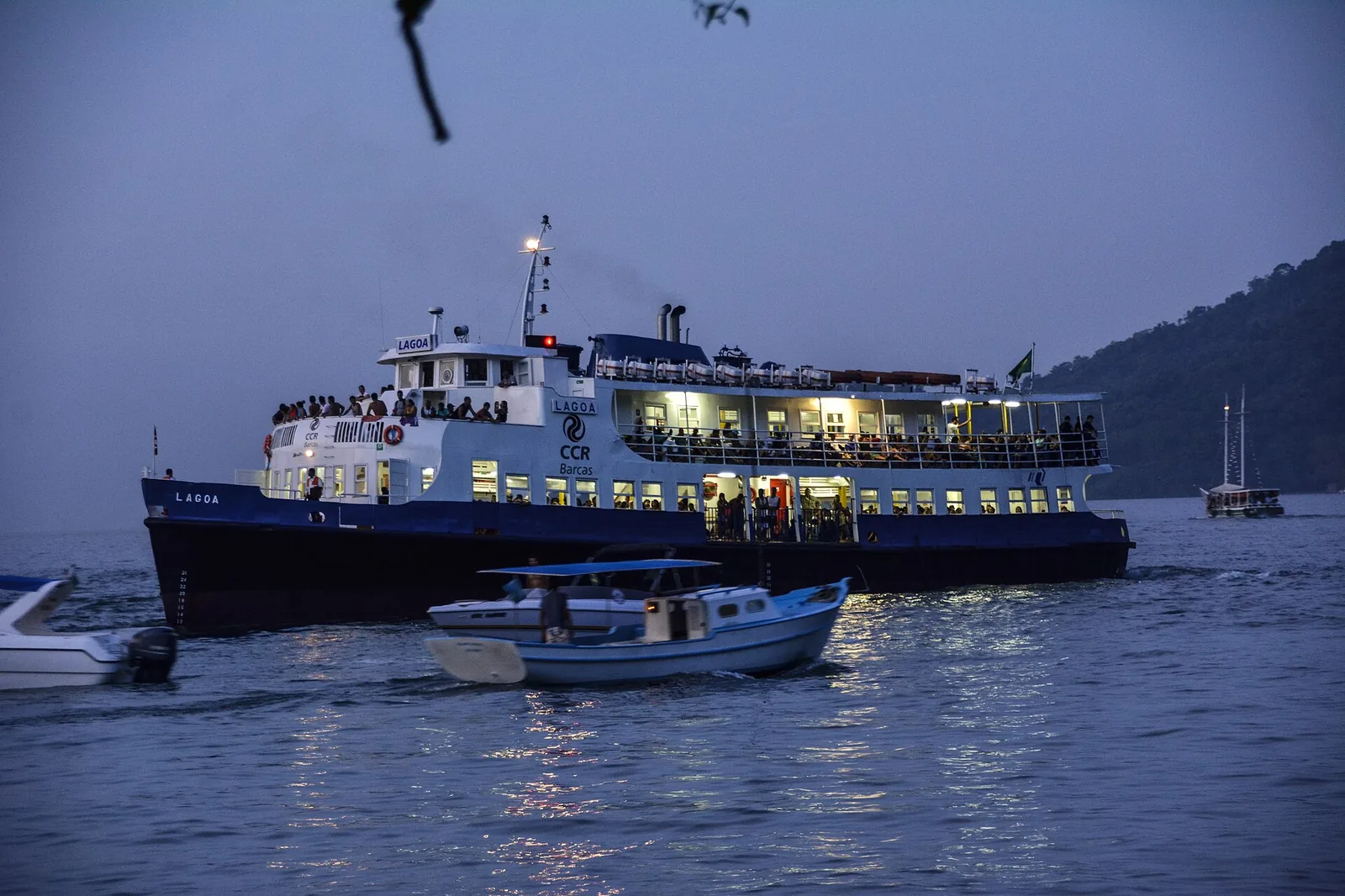
One more structural point worth grasping early: trails and boats work together here. Plenty of the best walks are most enjoyable as a one-way hike with a boat ride for the other half — walk out, sail back, or the reverse. It saves your legs, doubles the scenery, and means you don't have to finish a long route in the heat of the afternoon.
What the walking is actually like
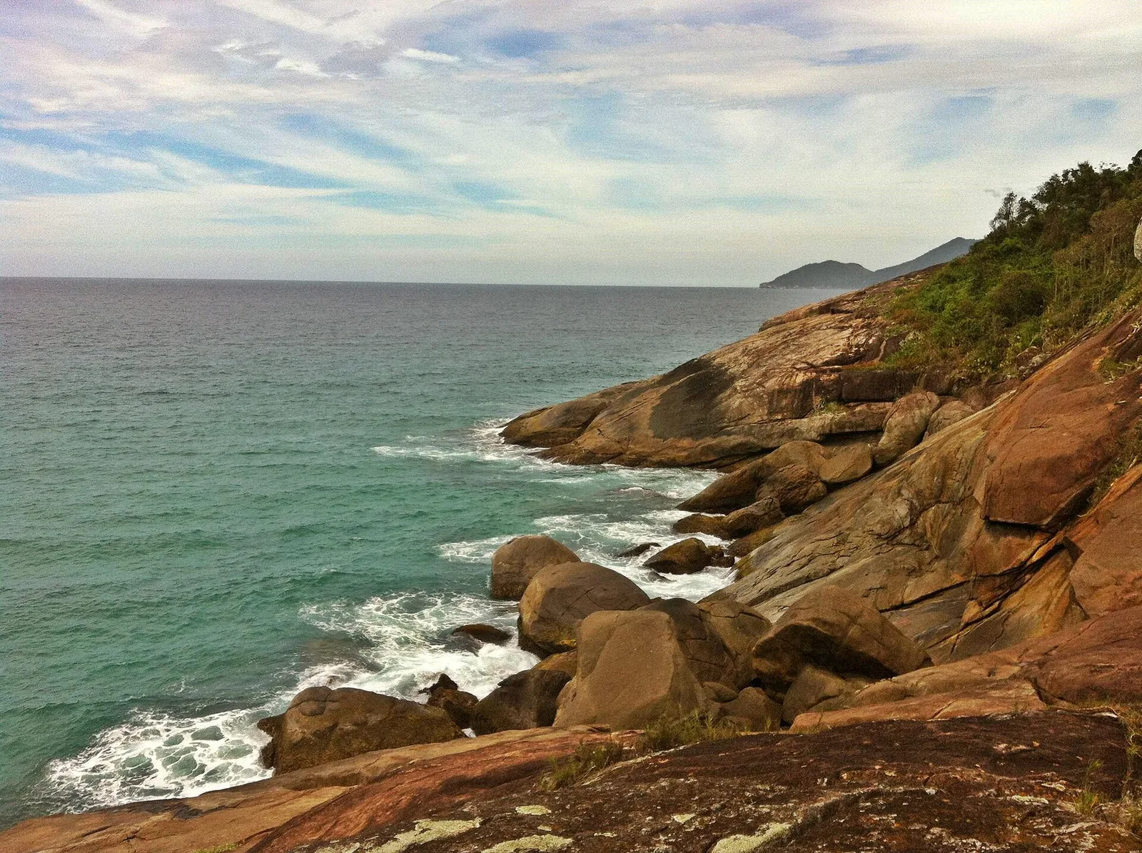
Set your expectations correctly and you'll enjoy these trails far more. This is rainforest hiking, not open-mountain ridge-walking. The paths are mostly enclosed by dense, humid forest, which means shade — a blessing in the heat — but also limited views except where the trail breaks out onto a headland, a beach or a summit. Underfoot you get earth, roots, rock and the occasional stream crossing, and after rain a good deal of mud and slick stone. Gradients vary from flat coastal sections to genuinely steep climbs on the summit and cross-island routes. The distances on paper look modest, but the heat, the humidity and the terrain make them feel longer than the same number of kilometres would at home, so add time to any estimate and don't try to march. The reward is the forest itself: the light filtering through the canopy, the constant soundtrack of insects and birds, the smell of wet leaves and earth. People who treat these trails as a means to an end miss half of what makes them special. On a good day, the walk is the holiday rather than the way to it.
The forest swallows the light early and the heat is no joke — on Ilha Grande the trails are the reward and also the thing to respect.
The easy routes near Abraão
If you want a taste of the forest without a commitment, start with the short trails that loop out of the village. The Abraão circuit (signed as T1) is the gentle classic: a flat, well-shaded couple of kilometres that takes about an hour and strings together a clutch of the island's most accessible sights — a viewpoint or two over the bay, the dark-sand Praia Preta, the ruins of the old Lazareto quarantine station, the stone aqueduct that once served it, and a small forest waterfall at Feiticeira that's a popular cool-off. It's easy enough for almost anyone and a good way to get your bearings and your forest legs on the first afternoon.
A step up but still relaxed is the walk over to Saco do Céu (T2), a calm, deep inlet on the sheltered side famous for its still water and its sunsets — a couple of hours each way through the forest, mostly easy, and a fine objective for a half-day if you'd rather walk than take a boat. Both of these are doable without a guide, in trainers, with water and sunscreen.
The other gentle reward near the village is the Feiticeira waterfall, reached on a short forest path that branches off the eastern trails not far from Abraão. It's a small fall with a pool to cool off in, popular and easy to reach, which means it gets busy at weekends — go on a weekday morning and you may have it to yourself. Pair it with the start of the Lopes Mendes trail and you have a pleasant, undemanding half-day that still feels properly in the forest. These short routes are also the best way to test how your body handles the island's heat and humidity before you commit to anything longer; if an hour in the forest leaves you wilting, scale back your plans for the harder trails accordingly.
The classic route: Abraão to Lopes Mendes
The most famous walk on the island is the one out to Lopes Mendes, the celebrated ocean beach. There are two ways to do it, and the choice matters.
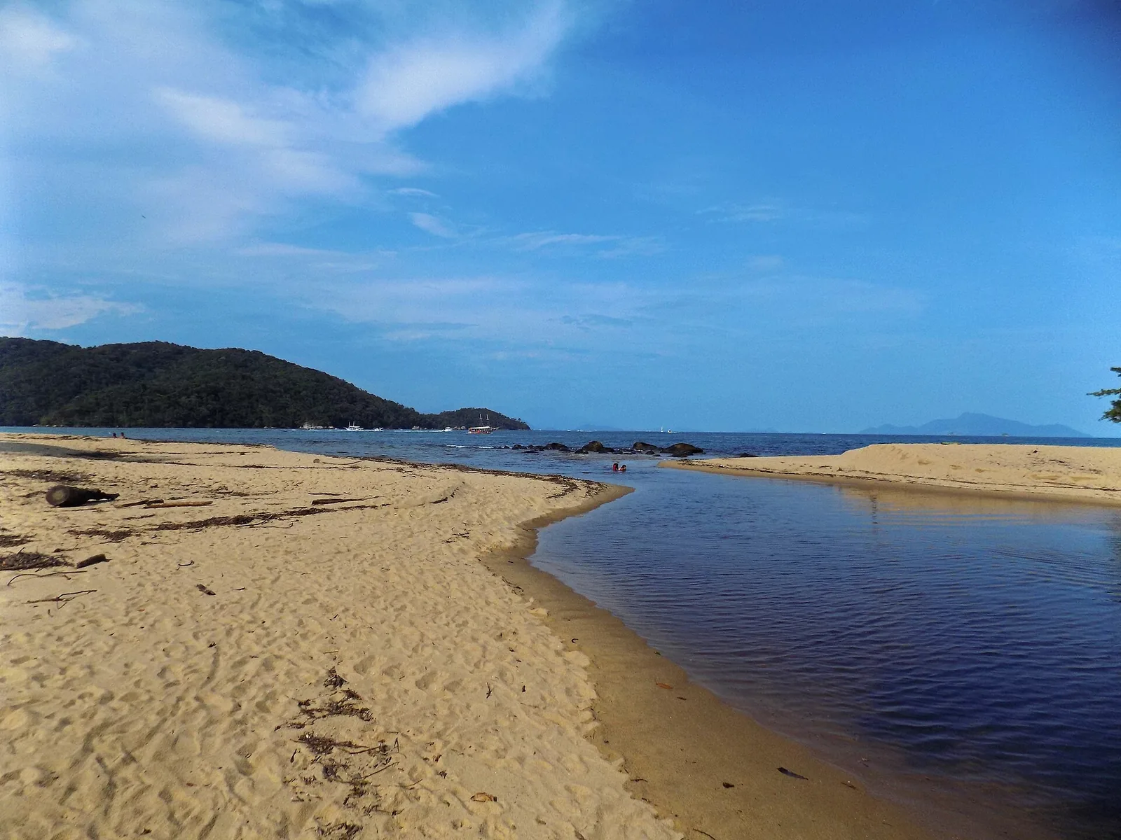
The full forest trail from Abraão (the T10 over to Pouso, then a short link to the beach) is roughly two and a half hours each way — a real hike rated medium, hot and humid, with ups and downs and slick, rooty ground in places even when it hasn't rained. It's a lovely walk in its own right, through deep forest with glimpses of the coast, but doing the round trip on foot makes for a long, sweaty day with limited beach time. The much more popular plan is to take a boat or water taxi across to Pouso beach and then walk just the last twenty minutes or so over the headland to Lopes Mendes — the same beautiful arrival, a fraction of the effort. Most people boat at least one way. Whichever you choose, the beach itself has no facilities, so carry water and food; the full picture is in our Lopes Mendes guide.
The summit: Pico do Papagaio
The big one. Pico do Papagaio — Parrot's Peak — is the iconic summit hike, and the toughest popular trail on the island. The marked route (T13) climbs from near sea level to around 980 metres at the top, through steep, irregular, often slippery forest, and the full out-and-back from Abraão takes most people something in the region of six to seven hours. It's rated difficult, and the rating is honest: this is a genuine mountain walk, not a stroll with a view at the end. (For the record, the very highest point on the island, Pico da Pedra d'Água, is higher still at over a thousand metres, but Papagaio is the one people climb.)
The reward is one of the great panoramas on this whole coast: a 360-degree view from the granite summit over the forested ridges, the scattered islands, the bays of Angra and, on a clear day, the mainland mountains beyond. Many people do it as a sunrise hike, setting off from the village in the dark — often around two or three in the morning — to reach the top for first light, when the bay below fills with cloud and colour. It's spectacular and it's demanding, and doing it in darkness is precisely why it's almost always done with a local guide.
If you take on Papagaio, treat it seriously: it's the one trail on the island where being underprepared can turn a great day into a dangerous one. Go with a guide unless you're an experienced hiker with the right kit and a good map, start early, and be honest about your fitness. There's no shame in turning back; the mountain isn't going anywhere.
A few specifics for the sunrise version, since it's the one most people are curious about. You'll typically meet your guide in Abraão in the small hours and walk by headtorch, which is a strange and rather wonderful experience in itself — the forest at night is loud with insects and the occasional rustle, and the climb is steep enough that you'll be warm despite the dark. The aim is to reach the granite summit just before first light, when the bay below often fills with cloud and the sky colours behind the islands. It's cold and exposed up top before the sun arrives, so carry a warm layer even though it seems absurd packing one for a tropical island. The descent in daylight is faster but hard on the knees after a sleepless start; trekking poles help if you have them. It is, for the right person, the single best thing you can do on Ilha Grande — but it asks a lot, and it's not for everyone, and that's fine.
If the full summit is more than you want, there are gentler viewpoints. The short circuit out of Abraão takes in lookouts over the bay, and several of the mid-length trails crest a saddle or a headland with a fine outlook for a fraction of the effort. You don't have to climb a thousand metres to get a view worth the walk.
Across the island: Dois Rios and the prison ruins
For history with your hike, walk across the island to Dois Rios, on the wild ocean side, where two rivers meet the Atlantic and the old Cândido Mendes penal colony once stood. The route from Abraão (the T14) follows what's essentially an old dirt road for around seven to eight kilometres — mostly graded and walkable, around two to three hours each way, though the rating leans towards difficult mainly for its length and a couple of climbs rather than any technical difficulty. It's a good, steady walk through the forest with a real destination at the end.
That destination is one of the more haunting places on the island. The prison was largely dynamited when it closed in 1994, and what remains — the reconstructed ruins and a quiet, almost eerily peaceful little village — now houses a small prison museum, the Museu do Cárcere, telling the story of the political prisoners and the hardened criminals who were held here, and of the island's strange institutional past. The beach at Dois Rios is long, wild and usually near-empty. Many walkers do the trail out and arrange a boat back, or vice versa; check the museum's opening days before you commit, as it isn't open every day. Beyond Dois Rios, longer trails continue to remote ocean beaches like Parnaioca for those wanting a serious, all-day expedition.
The contrast is what makes this walk memorable: you spend a couple of hours in living forest, then arrive at the relics of one of Brazil's most notorious prisons, set against an empty Atlantic beach. It's history and nature on the same afternoon, and a useful corrective to the postcard version of the island — a reminder that the very emptiness you've come to enjoy has a darker origin. Bring water and a packed lunch; there's little to nothing in the way of services at Dois Rios, and the village, though inhabited, is sleepy. If you're walking back rather than catching a boat, leave yourself plenty of daylight for the return.
The big one: walking around the island
For experienced, fit hikers there's a greater prize: a multi-day circuit of the island, linking the marked trails into a near-complete loop of the coast over two, three or more days, camping or staying in the tiny settlements along the way. It strings together the wild ocean beaches, the remote coves, the forest interior and the high ground into one of the more rewarding long treks in this part of Brazil. It is not a casual undertaking — it demands real fitness, proper planning around water, food and shelter, and ideally a guide who knows the linking sections, some of which are rough, faint and exposed. Conditions on the remoter stretches can change quickly, and help is a long way off. If a multi-day trek appeals, plan it carefully and don't attempt the harder linking trails alone or underprepared. For most visitors, a couple of the classic day routes give you the essence of the island's hiking without the commitment; the full circuit is for those who specifically want an expedition.
The gentle objectives: Lagoa Azul and the calm coves
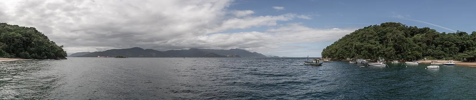
Not every good day on Ilha Grande involves a hard climb. Several of the loveliest spots — the Lagoa Azul blue lagoon, Lagoa Verde, and the calm snorkelling coves on the sheltered north side — are really boat objectives, sometimes with a short, easy walk attached. If your group has mixed appetites, or you simply want a low-effort day, these are the answer: a boat across, a swim in flat clear water, a short stroll, and back. They pair naturally with a half-day of gentle walking, and they keep the non-hikers in your party as happy as the summit-baggers. The boat-and-snorkel side of the island is covered more fully in the island guide.
Guides versus self-guided
Whether to hire a guide comes down to which trail and which conditions. Here's my honest steer.
Go without a guide on the short, busy, well-signed routes near Abraão — the village circuit, the easy beach walks, the Pouso-to-Lopes-Mendes hop. They're hard to get badly lost on, plenty of other walkers are about, and you'll be fine with water, sensible shoes and an offline map.
Take a guide for the demanding trails: Pico do Papagaio (especially the dark-start sunrise version), the longer cross-island and ocean-side routes, anything in marginal weather, and any walk where you're not confident of the navigation. A good local guide does three things worth paying for — keeps you on the right path where the signing fails, sets a safe pace and turnaround time, and reads the conditions (heat, cloud, tide) far better than a visitor can. Guides can be arranged easily in Abraão or in advance; if you'd like help lining one up as part of a trip, our tours page is the place to start.
There's a less obvious benefit too. A good guide turns a walk through anonymous green into a walk through a place you understand — which plant is which, where the howler monkeys den up, how the prison shaped the trails you're following, where the water is safe to drink. On an island whose whole character comes from its history and its forest, that context is worth as much as the navigation. Even confident hikers who'd happily go alone often hire a guide for one walk simply to learn the island, then strike out on their own for the rest. If you do go independent, the courtesy is the same one you'd expect anywhere: greet the people you pass, stand aside for those coming uphill, and don't blast music into a forest everyone else came to hear.
Wildlife you'll meet on the trail
The forest is full of life, and most of it is a pleasure rather than a problem. The sound that startles first-timers is the deep, roaring call of howler monkeys carrying through the canopy, especially at dawn and dusk — it sounds far larger and fiercer than the animal making it, and it's entirely harmless. You may spot smaller monkeys in the trees, lizards on the rocks, the occasional capybara or agouti at the forest edge, and an enormous variety of birds and butterflies. Offshore and on the boat legs you may see turtles and, in season, dolphins. There's nothing on the island that should frighten you on a normal walk; the sensible precautions are the universal ones — watch where you put your hands and feet on rocky and overgrown sections, don't disturb anything, and give any animal a wide berth. Bring repellent for the mosquitoes, which are most active in the forest at dawn and dusk, and that's about the worst of it.
Trail conditions through the seasons
The same trail can feel very different depending on when you walk it. In the drier, cooler months — broadly April to early January, at their best from around August to December — the ground is firmer, the streams lower and easier to cross, the views from the high points clearer, and the chance of a soaking far lower. This is the window I'd choose for the harder routes and the summit. In the wet height of summer, roughly December to March, the forest is at its lushest and greenest, but the trails turn muddy and slippery, the humidity is punishing, streams can run high, and a downpour can arrive without warning and rob a summit of any view at all. You can hike year-round, and a wet-season walk on the easy coastal trails is perfectly enjoyable, but if hiking is a priority, lean towards the drier stretch and keep the bigger climbs for the clearer, more settled days. Whatever the season, the morning after heavy rain is the most slippery and the most likely to leave you scrambling on greasy rock — worth knowing before you set off.
Safety: heat, getting lost, tides
The trails here are beautiful and almost entirely benign — but the things that catch people out are predictable, which means they're avoidable. Take these seriously and you'll have nothing but good days. None of them are exotic; they are the ordinary mistakes, made in an unfamiliar place.
- Heat and dehydration are the number-one risk. It's hot and humid under the canopy, and you'll sweat far more than you expect. Carry more water than feels necessary — at least a couple of litres each for any longer walk — and drink steadily rather than waiting until you're thirsty. There are no taps or shops on the trails.
- The forest goes dark early. Under the canopy the light fades well before actual sunset, and finishing a long trail in the gloom is exactly when people lose the path and get hurt. Start early, build in a generous margin, and set yourself a turnaround time you'll actually obey. Carry a headtorch even on a day walk — if the day runs long, you'll be very glad of it.
- Don't rely on the signs alone. They're mostly good but not infallible. Carry an offline map, note junctions as you pass them, and if you're genuinely unsure which way to go, stop and work it out rather than pressing on and hoping.
- Tell someone your plan. Your pousada, a friend, anyone — which trail, and when you expect to be back. It costs nothing and it's the single most useful safety habit.
- Mind the tides on coastal sections. A few routes skirt the shore or cross beach sections that are easier at lower water; ask locally if your route is tide-sensitive, and don't get cut off.
- The wildlife is harmless. If you hear a loud, roaring growl from the canopy, it's howler monkeys, not anything to fear — one of the great sounds of the forest. Watch where you put your hands and feet on the rockier sections, and you'll be fine.
What to carry
A short, practical kit list that covers most of the island's trails:
- Water — two litres or more per person for longer walks, less for the short circuits.
- Proper shoes — trainers at a minimum, light hiking shoes ideally. The ground is rooty, rocky and slippery; flip-flops will betray you.
- Sun protection — high-factor sunscreen, a hat, sunglasses. The exposed beaches and viewpoints have no shade.
- Insect repellent — the forest has mosquitoes, especially at the edges and at dusk.
- A headtorch — essential for the sunrise hikes and a sensible just-in-case on any longer walk.
- Snacks and a packed lunch — there's nothing to buy on the trails; bring it from Abraão.
- A light rain layer — this is a rainforest; a shower can arrive without warning.
- Cash — for the boats that bookend many of the best walks, and the occasional beach vendor.
- An offline map and a charged phone.
- A dry bag or zip-lock for your phone, money and anything you need to keep dry on the boat legs and in the rain.
One thing to leave behind: rubbish. There are no bins out on the trails or the remote beaches, and this is protected forest and reserve. Whatever you carry in, carry out — including fruit peel and anything else organic, which doesn't belong on these paths in the quantities visitors would otherwise leave. The reason the island still looks the way it does is that the people who walk it treat it gently. Be one of them, and the trail will be just as good for whoever comes after you.
When to hike
Two timing decisions matter: the season and the hour. For the season, the drier, more settled months — broadly April to early January, at their best from around August through December — give you firmer ground, clearer summit views and a far lower chance of being caught in a downpour. The wet height of summer (roughly December to March) makes the trails muddier and slicker and the heat more oppressive, and a soaked summit gives you no view at all. You can hike year-round, but if hiking is a priority, lean towards the drier stretch.
For the hour, the rule is simple: start early. A morning start beats the worst of the heat, gives you a comfortable margin before the early forest dark, and catches the wildlife at its liveliest. Save the afternoons for the beach, the village or a boat. The only exception is the deliberate pre-dawn start for a sunrise summit — and that's a guided, planned thing, not a casual decision.
Fitting the trails into a trip
You don't have to choose between hiking Ilha Grande and the comforts of a proper base. The smart pattern for many of our guests is to keep their home on the mainland near Paraty and treat the island's trails as a day out — cross over in the morning, walk to Lopes Mendes or up to a viewpoint, and come back to a real bed, a hot shower and a kitchen rather than carrying everything onto and off the island. From Château Portofino, set high above the Bay of Paraty, you can see Ilha Grande on the horizon and reach the nearest crossing in an easy drive — the island's forest paths and the calm of a hillside chalet on the same trip.
The two approaches aren’t mutually exclusive, either. A common and satisfying pattern is to spend a night or two on the island so you can do an early-start summit or a longer cross-island walk without racing the boat timetable, then move back to the mainland to recover in comfort and explore the rest of the coast at a gentler pace. You get the serious hiking when you’re rested and on the spot, and a proper base for everything else — the waterfalls, the colonial town, the bay tours — for the days your legs need a rest.
If you want longer or more committing walks, or you're set on the Pico do Papagaio sunrise, it's worth basing yourself in Abraão for a night or two so you're on the spot at first light, then returning to the mainland for the rest of your time. Either way, we're glad to help you work out which trails suit your group, which to guide and which to do alone, and how to slot an island day into a wider Costa Verde itinerary. Have a look at the region for the bigger picture, and get in touch when you want a hand planning it. The trails are the best way to see the real Ilha Grande — give them the respect they ask for, and they'll give you the island in return.
Frequently asked questions
With a simple T-and-number system. Each marked route carries a code such as T10, T13 or T14, signed at junctions and trailheads, linking the village of Abraão to the beaches, viewpoints, peaks and historic sites. Carry an offline map as well, because signs can be missing or weathered.
Hard. The summit trail climbs from near sea level to around 980 metres through steep, often slippery forest, and the full out-and-back from Abraão takes most people roughly six to seven hours. It's the toughest popular hike on the island and is usually done with a local guide, often starting in the dark for the sunrise.
The short coastal circuit out of Abraão — past the old aqueduct, the Lazareto ruins and a couple of viewpoints to nearby beaches — is flat, well-shaded and takes about an hour. The boat-to-Pouso then short walk to Lopes Mendes is also easy once you've crossed by water.
Not for the short, well-trodden routes near Abraão. For the longer or higher trails — Pico do Papagaio, the cross-island walk to Dois Rios, anything done at night or in poor weather — a local guide is strongly recommended for safety and navigation, and the sunrise summit hikes are almost always guided.
Roughly two and a half hours each way along the forest trail. Most people instead take a boat to Pouso and walk about twenty minutes over the headland, then return by boat — a much shorter day with more time on the beach.
Early morning. You beat the worst of the heat, you have margin before dark, and the forest is at its most alive. Avoid starting a long trail in the afternoon — the canopy makes the forest dark well before sunset, and finishing in fading light is when people get into trouble.
Yes, with sense. The real hazards are heat and dehydration, slippery ground, and getting lost or caught out by darkness on the longer routes. Carry plenty of water, wear proper shoes, start early, tell someone your plan, and take a guide on the harder trails. Tides matter on a few coastal sections too.