In this guide
Most people arrive in Paraty for the picture: a colonial town of whitewashed houses and blue-and-ochre trim, standing at the edge of a bay strewn with green islands, the Atlantic forest rising steep behind. What far fewer arrive knowing is that the whole of it — the town, the bay, the islands and the mountains together — carries one of the most demanding distinctions the world hands out. In 2019, UNESCO inscribed Paraty and Ilha Grande on the World Heritage List, and it did so in a category almost nothing else in Brazil holds.
This is the story of why. It is not, as the souvenir shops sometimes suggest, simply that Paraty is old and pretty. Plenty of places are old and pretty. What earned the listing is something rarer and more interesting: a single stretch of coast where an intact eighteenth-century town, a working gold-era landscape, one of the planet's most threatened forests and a bay full of biodiversity all sit inside one boundary and explain one another. The Paraty UNESCO World Heritage designation is a recognition that here, uniquely, culture and nature are not two attractions but one continuous thing.
Understanding that changes how you see the place. Once you know what the inscription actually protects — and why the committee argued about it, and what it asks of the people who live and visit here — a walk through the old town or an afternoon on the water stops being sightseeing and becomes something closer to reading. What follows is the full account: the 2019 listing and how it works, the gold that built the grid you walk on, the forest that survived because the boom went bust, and, plainly, what all of it means for you when you come to stay.

What UNESCO actually recognised in 2019
On 5 July 2019, at the 43rd session of the World Heritage Committee in Baku, Azerbaijan, a property with a slightly unwieldy official name — "Paraty and Ilha Grande – Culture and Biodiversity" — was added to the World Heritage List. It was Brazil's first mixed site: a place recognised for both its cultural and its natural value at the same time, under the same inscription. That "mixed" status is the heart of why the Paraty UNESCO World Heritage listing matters, and it is genuinely uncommon. Of the thousand-plus sites on the list worldwide, only a few dozen are mixed. Most places are recognised as either cultural or natural. Paraty is both, and the argument for it is that you cannot honestly separate the two.
UNESCO judges every candidate against ten criteria — the first six cultural, the last four natural. A property has to satisfy at least one to be inscribed. Paraty and Ilha Grande satisfies two, one from each side of the line. It meets criterion (v), the cultural test for an outstanding example of a traditional human settlement and land-use that represents a culture and its interaction with the environment, especially when that way of life has become vulnerable. And it meets criterion (x), the natural test for containing the most important and significant habitats for the in-situ conservation of biological diversity, including threatened species of outstanding universal value.
Read those two lines together and you have the whole case in miniature. One clause is about people — a colonial port town, the traditional communities of the coast and forest, a landscape shaped by three centuries of human use. The other is about wild things — an Atlantic forest crammed with species that live nowhere else, protected inside four conservation units. The committee's point was that at Paraty the human story and the natural story are braided so tightly that to protect one you must protect the other. That is the idea the inscription defends.
Why "mixed" is the hard distinction
It is worth pausing on how difficult that dual recognition is to earn, because it explains the pride you will notice in the town. A mixed site has to clear two entirely separate bars, assessed by two different advisory bodies — ICOMOS for culture, IUCN for nature — each with its own exacting standards and its own habit of saying no. A candidate that is merely a beautiful old town with some nice forest nearby does not pass. It has to be, on its own, both a cultural site of outstanding universal value and a natural site of outstanding universal value, and it has to show that the two are genuinely integrated rather than merely adjacent. Paraty's dossier took years to assemble and was, in the end, one of the more persuasive of its kind. When locals tell you the listing was a big deal, they are not exaggerating.
Nothing here is arbitrary — the grid is laid to the tides, the road climbs the pass the gold needed, and the forest survives because the money left.
Two halves of one listing: culture and biodiversity
The cleanest way to understand the inscription is to take its two criteria in turn, because each protects something different and each is worth seeing on its own terms.
The cultural half: a colonial coast frozen by its own decline
The cultural case rests, first, on the historic centre of Paraty — one of the best-preserved colonial coastal towns anywhere in Brazil. Its streets are laid to an eighteenth-century plan, its buildings are genuinely old rather than reconstructed, and, crucially, the whole ensemble survives as a coherent living town rather than a museum. Beyond the streets, the cultural component takes in the Morro da Vila Velha — the hill above the town where the archaeological remains of the Defensor Perpétuo fort sit — a preserved stretch of the Caminho do Ouro, the colonial gold road climbing into the mountains, and a scatter of archaeological sites that record how long people have lived along this coast, from Indigenous occupation through the colonial centuries.
But the cultural value is not only in stone. Criterion (v) is specifically about a way of life, and here that means the traditional communities of the coast and forest — the caiçara fishing and farming people of the shoreline and islands, the quilombola communities descended from formerly enslaved Africans, and the Indigenous Guarani. Their fishing, their small-scale farming, their boat-building and their knowledge of this landscape are part of what the listing recognises and part of what it commits Brazil to safeguarding. You can read more about that living culture in our guide to caiçara life on this coast; it is not a backdrop to the heritage, it is a load-bearing part of it.
The natural half: a hotspot inside a hotspot
The natural case rests on the Atlantic Forest — the Mata Atlântica — which is recognised globally as one of a small handful of the planet's most important biodiversity hotspots. A hotspot, in conservation terms, is a place carrying an extraordinary concentration of species found nowhere else, under an extraordinary degree of threat. The Atlantic Forest qualifies on both counts: it once ran in a near-unbroken band down Brazil's entire eastern seaboard and has been reduced, over five centuries, to a fraction of its former extent, scattered in fragments. What remains is precious precisely because so little of it is left.
The section protected at Paraty and Ilha Grande is among the richest of what survives. The area holds an exceptional number of endemic plants — species that exist here and only here — including a set of rare plants found nowhere else on Earth. The forest shelters big cats, primates on the edge of extinction, and hundreds of bird species. And because the property runs from the sea to over two thousand metres of altitude, it stacks several distinct habitats — coastal, montane, highland — inside a single boundary, each with its own community of living things. Our journal piece on the wildlife of the Atlantic forest goes deeper into what actually lives up there, but the short version is that criterion (x) was not a close call.
.jpg)
Six pieces of one landscape
One thing that surprises people is that the World Heritage site is not a single fenced area. It is what UNESCO calls a serial property: a set of separate component parts, managed together under one inscription and wrapped in a single shared buffer zone. Paraty and Ilha Grande has six components, and knowing them helps you see how much ground the listing actually covers — well over a hundred thousand hectares of core zone across two states, Rio de Janeiro and São Paulo.
The six pieces are, in essence, four protected natural areas plus two cultural sites:
- Serra da Bocaina National Park — the great federal park in the mountains behind the coast, running from sea level to over 2,000 metres and holding some of the largest surviving Atlantic forest anywhere. Our full Serra da Bocaina guide covers walking into it.
- Cairuçu Environmental Protection Area — the protected coastal zone south of Paraty, taking in the traditional communities, the beaches of the peninsula and the fjord-like inlet of the Saco do Mamanguá.
- Ilha Grande State Park — the mountainous, forested heart of the great island across the bay, laced with hiking trails and ringed by beaches.
- Praia do Sul Biological Reserve — a strictly protected reserve on Ilha Grande's wild ocean side, off-limits to casual visitors precisely so its ecosystems stay intact.
- The Historic Centre of Paraty — the colonial town itself, the cultural anchor of the whole property.
- Morro da Vila Velha — the fort hill above the town, with its archaeological remains.
Notice the logic. The two cultural pieces sit at the coast, where people built and traded. The four natural pieces climb from the water into the mountains and out across the bay, protecting the forest and sea that the human settlement depended on. Together they trace a single system: a port at the foot of a mountain pass, the road up into the interior, the forest the road crossed, and the bay and islands the ships sailed through. The map itself tells the story. You can get a feel for how the pieces fit on our satellite map of the region.
The gold-cycle town: how Paraty got its plan
To understand why the old town looks and works the way it does, you have to go back to gold. Paraty is a gold-cycle town, and almost everything distinctive about it — the street grid, the grand churches, the port, even the reason it survived so intact — traces back to one violent, dazzling episode of Brazilian history.
For Brazil's first two colonial centuries the interior was largely a blank to the Portuguese crown, apparently empty of the mineral wealth the Spanish were extracting elsewhere in the Americas. Then, at the very end of the 1690s, bandeirante expeditions pushing inland from São Paulo struck gold in the mountains of what became Minas Gerais — "the general mines." For a time it was the richest gold strike the world had seen, and it set off a rush that pulled people and money into the interior on an enormous scale.
The problem was getting the metal out. The mines lay hundreds of kilometres inland, walled off from the sea by the Serra do Mar escarpment. Of all the points on the coast, the sheltered bay at Paraty happened to sit at the foot of one of the few passes a laden mule train could climb. So Paraty became the port of the gold cycle: the place where gold came down off the mountains, was weighed and taxed, and was loaded onto ships bound, by way of Rio de Janeiro, for Lisbon. Up the same road went everything the mining districts could not produce — salt, iron, tools, cloth, and the enslaved Africans whose forced labour drove the entire economy.
The grid, the water and the tides
The wealth that passed through built the town you walk today, and it built it to a plan. The historic centre is laid out on a regular grid of streets, deliberately oriented, and paved with the large irregular stones — the pé de moleque paving — that still make walking a slow, ankle-testing pleasure. Look closely and you will see the streets were built to work with the sea rather than against it. The town sits at the meeting of rivers and bay, and the grid is aligned so that the highest spring tides wash up the streets and flush them clean, then drain away — a piece of eighteenth-century sanitary engineering that still functions on a full moon, when parts of the centre flood ankle-deep and the buildings appear to float on their own reflections. It is one of the quiet marvels of the place, and it is no accident.
The absence of cars is not a modern affectation either; the streets were never built for wheels, and keeping motor traffic out of the historic core is part of how the listing protects it. What you get, as a result, is a town centre that sounds like the eighteenth century: footsteps on stone, hooves occasionally, water, voices, music from an open door. We go street by street in the historic centre guide, but the thing to carry with you is that the layout is not decorative. It is a document.
Churches, class and the order of the town
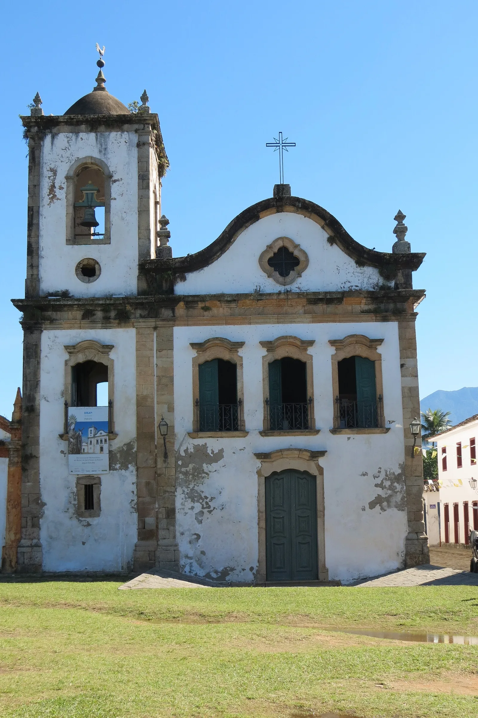
The gold town organised itself, as colonial Brazilian towns did, partly through its churches — and Paraty kept several, each historically associated with a different group in a rigidly stratified society. The largest, Nossa Senhora dos Remédios, faces the main square. Santa Rita, the small and much-photographed church near the waterfront, is the oldest and was linked to freed people of mixed race. Nossa Senhora do Rosário was associated with enslaved and free Black residents. Nossa Senhora das Dores was the chapel of the white elite. That you can still read the town's social order in the placement and character of its churches is part of what makes the centre such a complete historical record, uncomfortable parts included. A good local guide will tell you the whole of it, not just the pretty half.

The Caminho do Ouro: the road that explains everything
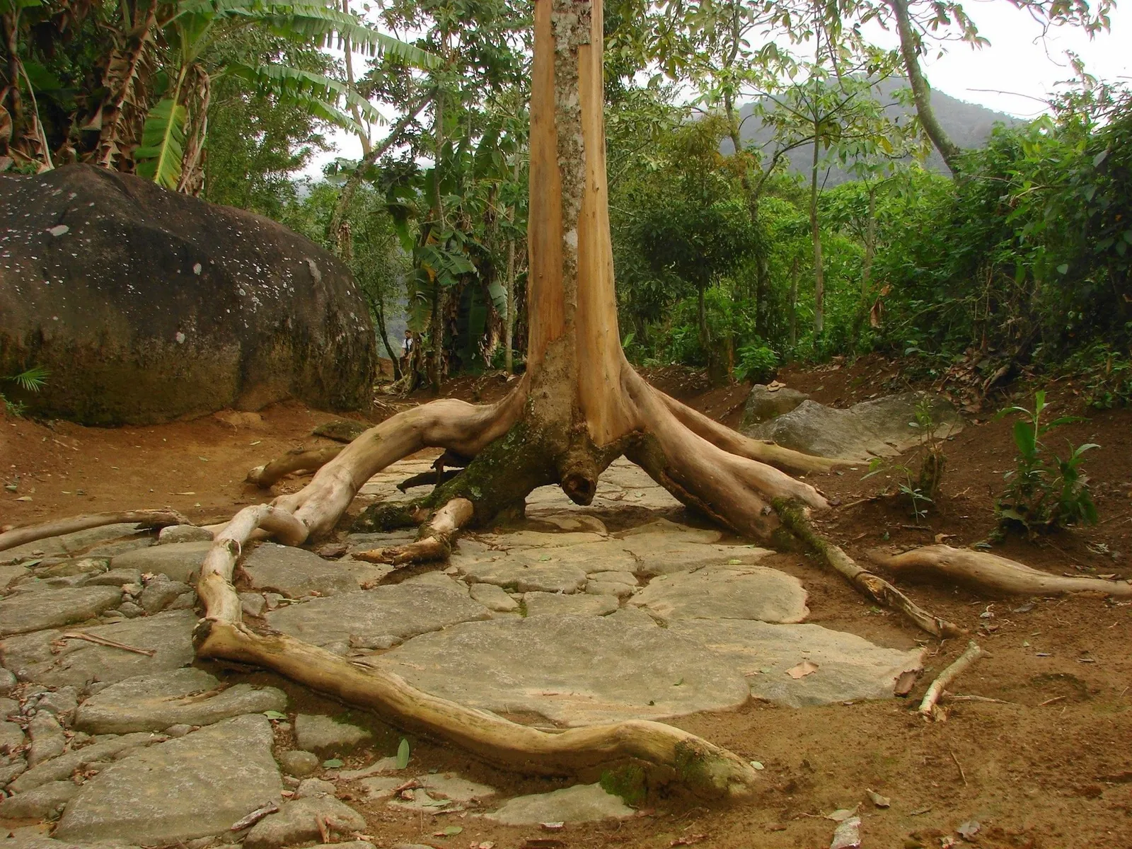
If one feature ties the cultural and natural halves of the listing together, it is the gold road itself. The Caminho do Ouro — the Gold Trail — is the colonial stone route that climbed the Serra da Bocaina to connect the interior mines with Paraty's harbour. A preserved stretch of it lies within the national park and forms part of the cultural component of the World Heritage site, which is fitting, because the trail is the physical link between the town at the bottom and the forest at the top.
Parts of the original road survive in the forest above town, paved in its steepest sections with large hand-set stones that have withstood nearly three centuries of tropical rain. It was part of the wider network later called the Estrada Real, the "Royal Road." You can walk the preserved sections today on a guided visit, and it is one of the most affecting hours in the region — not because the paving is spectacular in itself, but because of what it carried and who laid it. The stones were cut and set by enslaved hands; the gold that went down and the supplies that came up moved on the backs of mules and people. The better guides do not soften that. Our Gold Trail guide has the practical detail — where the trailhead is, when visits run, what to wear on wet stone — but understand the walk as the through-line of the whole heritage story. When the boom moved on, this road was abandoned, the forest grew back over it, and both the road and the town were left behind. That neglect is exactly why they survive.
Why the forest survived: the accidental preservation
Here is the paradox at the centre of Paraty's World Heritage status: the place was saved by failure. Paraty boomed on gold for a few decades and then, when the crown opened a shorter, better-defended road from the mines straight down to Rio de Janeiro, the traffic abandoned it almost overnight. The town slid into a long, quiet poverty. There was a modest later revival on coffee and cachaça — the sugarcane rum the region still distils — but Paraty never regained its importance, and for the best part of two centuries it was simply too poor and too remote to change.
That is why the eighteenth-century town survives so perfectly: no one had the money or reason to knock it down and build something new. And it is a large part of why the surrounding forest survives too. The mountains that had been the region's great obstacle became its great protection. Roads stayed bad, access stayed hard, and the Atlantic forest that was being cleared everywhere else along the Brazilian coast was largely left alone here. By the time modern roads finally reached Paraty in the 1970s, the combination of an intact colonial town and an intact forest was so unusual that the impulse was to protect rather than develop. The conservation units followed; the heritage recognition, eventually, followed those.
So when you stand in the old town or look up at the green wall behind it, you are looking at the results of a two-hundred-year accident — a boom that left just enough behind and a bust that preserved it. The Paraty UNESCO World Heritage inscription is, in a sense, the formal acknowledgement of that luck, and a commitment to make sure the next chapter is deliberate rather than accidental. Our journal piece on Brazil's colonial towns sets Paraty alongside the others the gold cycle left behind.

The Serra da Bocaina and the biodiversity the listing guards
The natural criterion is not an abstraction; it protects specific, living things, and the mountains behind the coast are where most of them are. The Serra da Bocaina National Park is the largest of the property's natural components, and its defining feature is vertical range. Within a single protected area you pass from warm lowland forest at the shore, through cool montane cloud forest where mist hangs in the canopy and orchids crowd every branch, to open highland grassland where the night air genuinely bites. That stacking of habitats is why the biodiversity is so concentrated: each zone has its own set of species.
The park is a stronghold for animals that have vanished from most of their former range. Jaguar and puma both survive here, along with the smaller ocelot, though you are exceedingly unlikely to see a big cat and that is precisely the point — they persist because they keep away from people. The park holds a surviving population of the southern muriqui, the woolly spider monkey, the largest primate in the Americas and one of its most endangered. Brown howler monkeys are here too, and their rolling dawn chorus is one of the defining sounds of the Atlantic forest; you can hear it from high ground around the bay at first light. More than three hundred bird species have been recorded, from toucans to the jewel-bright saffron toucanet.
On the plant side, the significance is in the endemism. The area represents one of the richest concentrations of endemic vascular plants within the entire Atlantic Forest hotspot, including a set of rare species that grow nowhere else. That is the sort of fact that wins a natural criterion: not just abundant life, but life that would be lost from the world entirely if this particular forest were lost. Walking a guided trail here, or simply listening to the forest from a quiet vantage, you are inside the thing the listing exists to protect.
Ilha Grande and the bay
The other half of the property's name is Ilha Grande, the large island that lies across the water to the east, in the municipality of Angra dos Reis. Its inclusion is not geographic padding; the island carries two of the six components — the Ilha Grande State Park that covers its mountainous forested interior, and the strictly protected Praia do Sul Biological Reserve on its wild Atlantic side — and it extends the listing's logic out into the sea.
Ilha Grande has its own dark and useful history in this. For much of the twentieth century the island held a prison, and before that a quarantine station, and those grim institutions did to the island what poverty did to Paraty: they kept people and development out. The result is an island that is overwhelmingly forest and beach, with no through-roads and no cars in its main village, ringed by some of the clearest water and finest beaches on this coast. It is the marine and insular expression of the same story — human history, in this case an unhappy one, leaving nature intact almost by default. If you want the full picture of visiting it, our complete Ilha Grande guide and the shorter day-trip guide both cover the crossing, the beaches and the trails.
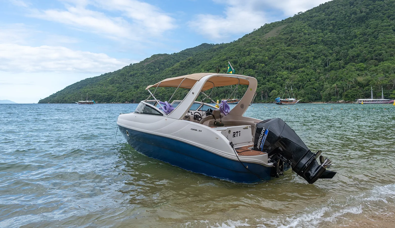
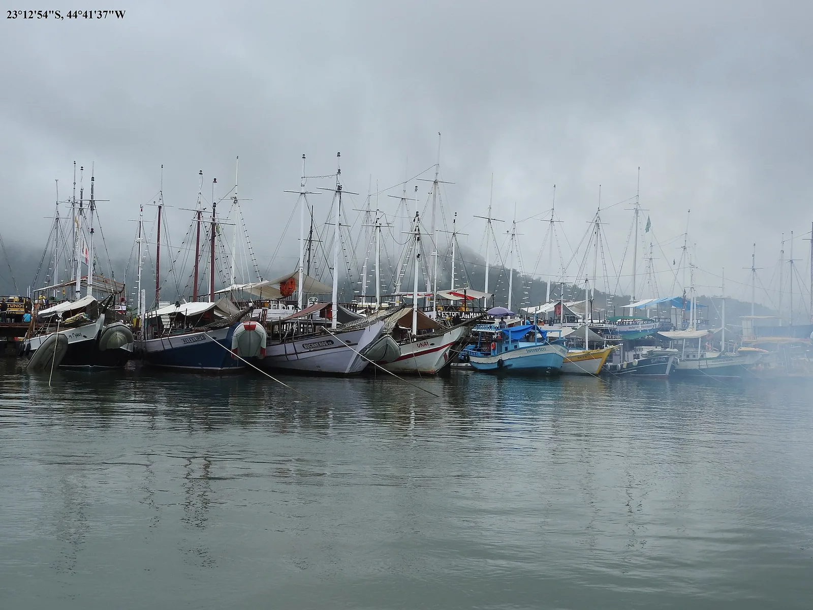
Between the island and the mainland lies the bay itself, dense with smaller islands, coves and clear anchorages. It is not, strictly, all inside the core World Heritage zone, but it is the connective tissue of the property — the water the gold ships crossed, the sea the caiçara communities still fish, the archipelago that a day on a boat threads through. Standing on it, with the town behind, the island ahead and the mountains rising on both sides, you see the whole inscription at once.
.jpg)
What the designation protects — and what it asks
A World Heritage listing is not just a plaque. It carries obligations, and it changes what can and cannot happen inside the property. Understanding that helps you be a good guest.
In practical terms, the inscription protects several things at once. It protects the fabric of the historic town — which is why the centre is kept car-free, why building alterations in the core are tightly controlled, and why you will not see the streetscape disrupted by modern signage or development. It protects the forest and the sea through the four conservation units, each with its own access rules, from the strictly off-limits biological reserve to the national park with its guided trails and daylight-only zones. And it protects the traditional communities and their way of life, which the cultural criterion explicitly recognises.
In return, the listing asks for management. Brazil committed to a coordinated management plan across all six components and two states — no small thing given the different agencies involved — and to keeping the property's outstanding value intact against the ordinary pressures of tourism, development and a warming climate. That is where visitors come in. The rules you meet on the ground — the guide required on the Gold Trail, the reef and mooring etiquette on a boat trip, the fee a local family charges to keep a waterfall path maintained, the request that you not take a car into the old town — are not bureaucracy. They are the mechanism by which a fragile place stays worth visiting. Treating them as part of the experience rather than an obstacle to it is the whole ethic of travelling somewhere like this.
The tension the listing has to manage
It would be dishonest to pretend the recognition is pure good news. World Heritage status draws visitors, and visitors bring both the money that funds protection and the pressure that threatens it. Paraty has grown busier since 2019, particularly in high summer and during its festivals, and the coast faces the same development and climate pressures as everywhere else. The listing is a tool for managing that tension, not a spell that dissolves it. As a traveller you are part of the equation: coming in the quieter seasons, staying somewhere that treads lightly, using local guides and boats, and spending in the local economy are all ways of being on the right side of it. We touch on the timing question below and in the best-time-to-visit guide.
What it means for a visitor
All of this history and designation resolves, for the person actually on holiday, into a landscape unusually dense with things to do that mean something. You are not choosing between a cultural trip and a nature trip; the whole point of the listing is that you get both, and that they are minutes apart.
Reading the town instead of just photographing it
Give the historic centre a proper morning on foot, ideally with a guide who knows the gold history. Walk the pé de moleque paving, find the four churches and learn what each one meant, stand in the main square in front of Nossa Senhora dos Remédios, and if you can time it for a high spring tide, come back after dark to see the streets flood and mirror the lantern light. The town rewards knowing what you are looking at far more than it rewards a fast circuit with a camera.
Walking the road that built it
Spend a morning on the Caminho do Ouro with a guide, then cool off in one of the waterfalls that share the same mountain road. This single outing gives you the cultural and natural halves of the listing in a few hours — the eighteenth-century engineering, the forest that reclaimed it, and a cold clear pool at the end. It is, for many guests, the most memorable day of the trip precisely because it is the whole story compressed.
Getting out on the water
Take a day on the bay — a schooner or a small private boat threading the islands, stopping to swim and snorkel in clear coves, with the option of the longer crossing to Ilha Grande. From the water you finally grasp the geography that made Paraty: the port, the pass, the sheltered archipelago. Our guide to the Saco do Mamanguá covers the quieter, fjord-like alternative to the day-boat circuit, if you would rather trade the busy islands for a still green inlet and a hard climb to a viewpoint.
Tasting the after-gold economy
When the gold left, cachaça stayed. The region around Paraty has distilled sugarcane rum for centuries, and visiting a working distillery in the hills is both a good afternoon and a direct taste of the economy that carried the town through its long quiet years. Our cachaça distilleries guide has the details; it pairs naturally with a mountain morning.
The gift of staying here is that none of these are far apart. You can read the town in the morning, be under a waterfall by noon, and watch the sun go down over the bay from a quiet vantage above it all. For a ready-made shape to the days, our Paraty itineraries lay out a few options by length of stay.
Seeing the whole heritage from one deck
There is a particular pleasure in taking in a landscape like this from above, where its pieces line up. Château Portofino sits about four hundred metres up the hillside above the bay, a short drive from the historic centre, and its one long deck and infinity pool look out over a rare thing: Paraty, Angra dos Reis and Ilha Grande all in a single view. That is not a marketing line so much as a geography lesson you can have with a coffee in hand. The town where the gold came down, the mainland coast where the islands cluster, and the great forested island that shares the World Heritage name are all laid out in front of you at once — the human half and the natural half of the inscription, in one frame.
It changes the rhythm of a heritage-minded trip. You go down into the town or out onto the water for the day, immersed in the detail — the paving, the churches, the reef, the forest — and then you come back up and see how all the pieces fit, from the one place that shows them together. The howler monkeys you might hear at first light are the national park's. The mist that drifts across the pool on a grey morning is the same cloud you watch catch on the Bocaina's ridges. The forest at the property's edge is the bottom edge of the thing UNESCO protects. You can read more about the setting on the chalet page. For a base from which to actually understand this coast, rather than just visit it, having the whole of it in view is worth a great deal.
A short plan for the UNESCO story
If you want to build a stay specifically around understanding why this place is a World Heritage Site, here is a simple three-day shape that covers both criteria without rushing:
- Day one — the town. A slow guided morning in the historic centre, learning the gold history, the grid, the tides and the churches. An unhurried lunch at the harbour end. An afternoon at leisure, and a return to the streets after dark, ideally on a high tide.
- Day two — the mountain and the road. A guided walk on the Caminho do Ouro, then a waterfall on the Cunha road to cool off, then back up to the pool by mid-afternoon with the bay below. A cachaça distillery on the way if there is time.
- Day three — the water and the island. A full day on the bay by boat, threading the islands and swimming in the clear coves, with the longer crossing to Ilha Grande if the sea is kind. This is the natural criterion at sea level, and the best way to grasp the geography.
Three days gives you the town, the forest, the gold road and the bay — the cultural half and the natural half, the two things the inscription binds together. Add a fourth day for the quieter corners: the Saco do Mamanguá, a distillery afternoon, or simply a day at the pool watching the weather move across the range. If you would like help arranging the guides and boats — the people we would send our own family to — a note to our concierge before you arrive is the easiest way to set it up.
Practicalities: getting here and when to come
Paraty sits on the Costa Verde, the green coast between Rio de Janeiro and São Paulo, and its position between the two big cities is part of what makes it reachable. From Rio de Janeiro it is roughly a four-hour drive southwest down the coastal BR-101, one of the more scenic road journeys in the country, with the mountains on one side and the sea on the other. From São Paulo it is a similar distance from the other direction, around five to six hours depending on traffic and where in the city you start. There is no major airport at Paraty itself; most international visitors fly into Rio or São Paulo and drive, or arrange a private transfer, from there.
On timing, the honest guidance is that Paraty has two faces. The Brazilian summer, from December to March, is hot, lush and lively, with the fullest waterfalls and the warmest sea, but also the biggest crowds, the highest prices and the most rain. The cooler, drier months from roughly April to October bring clearer skies, firmer footing on the trails, better long views from the heights, and a calmer town — at the cost of cooler water and, occasionally, a chilly evening. The festivals are their own consideration: the town's literary festival, FLIP, and the religious Festa do Divino both fill Paraty and are wonderful if you want the buzz and a challenge if you want quiet. Our best-time-to-visit guide weighs it all up in detail, but for a heritage-focused trip that leans on walking and long views, the drier shoulder months are the easy recommendation.
A few honest pointers
- Wear the right shoes. The old town's paving is uneven by design, and the forest trails are often wet stone. Bring footwear with grip and forget about anything delicate underfoot.
- Use local guides. The Gold Trail requires one, and the town, the forest and the bay all give far more with someone who knows the history and the species. It is also how the local economy shares in the visit.
- Carry some cash. Small access fees at waterfalls and beaches, boat tips and market stalls often run on cash, even where cards are common.
- Come with time. The single biggest mistake is treating Paraty as a day-trip photo stop. The whole value of the place is that its pieces connect, and connecting them takes days, not hours.
The last word: heritage you can live in for a week
What lifts Paraty above the ordinary run of pretty old towns is that its beauty is legible. Nothing here is arbitrary. The grid is laid to the tides, the churches map a vanished social order, the road climbs the pass the gold needed, the forest survives because the money left, the island stayed wild because it was a prison, and UNESCO drew a line around all of it in 2019 because you cannot understand any one part without the rest. The Paraty UNESCO World Heritage designation is, in the end, a way of saying that this whole braided landscape — human and wild, colonial and forested, town and bay — is worth keeping intact for the people who come after.
For a traveller, that is a rare gift: a holiday where the swimming and the eating and the boat trips happen to sit on top of a story worth knowing, so that the pleasure and the meaning reinforce each other. You can have a completely lazy week here and still absorb it, or you can lean in and read the place closely, and either way you come away having been somewhere that matters. From a quiet deck above the bay, with the town, the coast and the island all in view and the forest at your back, the whole of it is simply there to be taken in slowly, a swim and a coffee at a time.
That is the sort of stay this coast is built for — unhurried, close to everything, and set above a view that explains itself. When you are ready to see the World Heritage coast from the inside rather than the postcard, we would be glad to help you plan it.

Frequently asked questions
Paraty and Ilha Grande were inscribed in 2019 as Brazil's first mixed cultural-and-natural World Heritage Site. The listing recognises the intact colonial gold-era town and its way of life together with the exceptionally biodiverse Atlantic Forest and bay that surround it, on the grounds that the human and natural stories here cannot be separated.
It was inscribed on 5 July 2019, at the 43rd session of the World Heritage Committee held in Baku, Azerbaijan. The official name of the property is 'Paraty and Ilha Grande – Culture and Biodiversity.'
It protects six component parts under one inscription: the historic centre of Paraty, the Morro da Vila Velha fort hill, Serra da Bocaina National Park, the Cairuçu Environmental Protection Area, Ilha Grande State Park and the Praia do Sul Biological Reserve. Together these guard the colonial town, a preserved stretch of the gold road, the traditional coastal communities, and one of the richest surviving pockets of Atlantic Forest.
Both. It is a mixed site, recognised under one cultural criterion and one natural criterion at the same time — a rare distinction. Fewer than a few dozen of the world's thousand-plus World Heritage sites are mixed, and Paraty and Ilha Grande is the only one in Brazil.
The Caminho do Ouro, or Gold Trail, is the colonial stone road that climbed the mountains to connect the interior gold mines with Paraty's port. A preserved stretch inside Serra da Bocaina National Park forms part of the cultural component of the World Heritage site, and it is the physical link between the town at the coast and the forest above it.
Paraty boomed on gold for a few decades in the eighteenth century, then declined sharply when the crown opened a shorter route from the mines to Rio de Janeiro. The town became too poor and remote to change for nearly two centuries, so its eighteenth-century streets and buildings survived largely intact — and the surrounding forest was spared for the same reason.
For a trip focused on the historic town, the gold road and the forest trails, the cooler and drier months from roughly April to October are easiest, with clearer skies, firmer footing and fewer crowds. The December-to-March summer is hotter, lusher and livelier but busier and wetter. Festivals like FLIP and the Festa do Divino are wonderful but fill the town.