In this guide
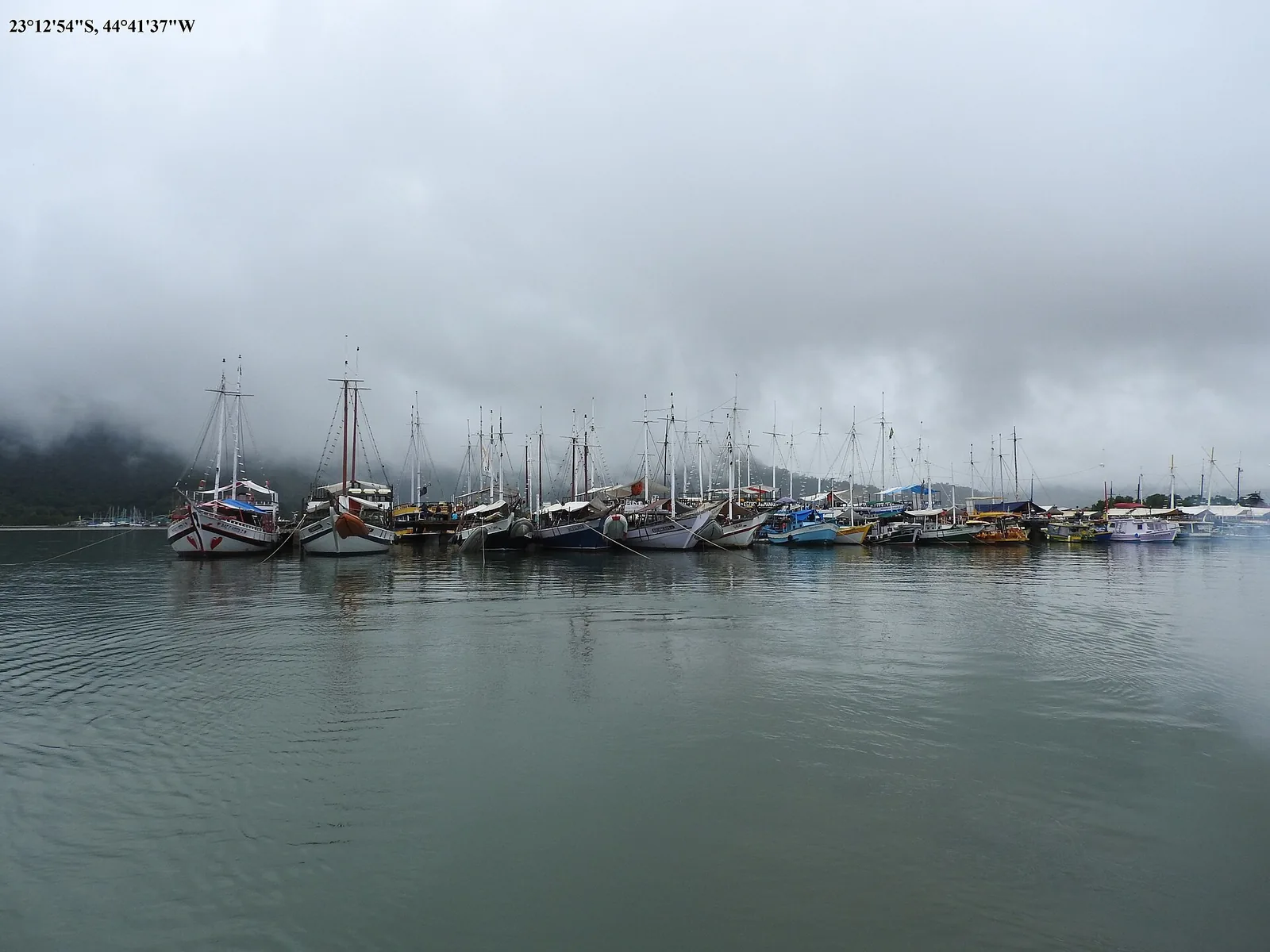
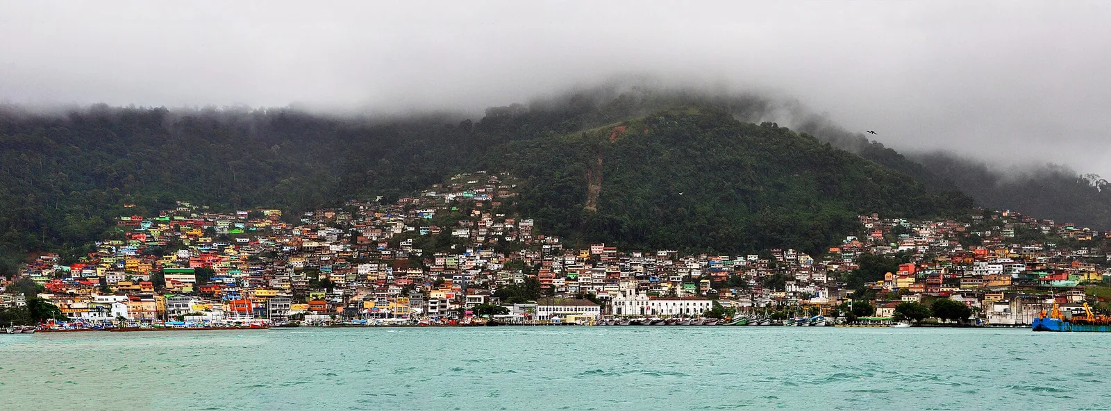
Stand on the seawall at Paraty on a still morning and the town seems almost too composed to have a violent past. The water is flat, the fishing boats sit at their moorings, and behind you the lime-white houses run back in neat lines toward the green wall of the Serra. It looks like a place that has always been exactly this quiet. It has not. For the best part of a hundred years this modest bay was one of the busiest and richest ports in the Portuguese empire, the point where the gold of an entire mountain range met the sea, and the calm you are looking at is the calm of a machine that stopped running two centuries ago and was left, remarkably, in place.
The history of Paraty gold is the history of the town itself, because gold is the reason there is a town here worth writing about. In the 1690s prospectors pushing into the highlands of the interior struck gold in quantities the modern world had not seen, and Paraty, sitting at the foot of the only practical pass down to a sheltered harbour, became the door through which that wealth reached the ocean. The houses, the churches, the very cobbles under your feet were built with the money that flowed through that door. And then, just as suddenly, the door closed. The gold found another road, the port emptied, and the town was left alone with its tides.
This is the story of that rise and fall, and of the long, strange afterlife that followed: the coffee and cachaça years that kept the town alive, the decades of obscurity that preserved it by accident, and the twentieth-century road that brought the world back. It is a story that runs, quite literally, through the mountains directly behind the chalet where you may be reading this, because the gold road climbed the same forested slopes we look out over from the terrace. If you are staying above the Bay of Paraty, you are not merely near this history. You are living on top of it.
.jpg)
Before the gold: a fishing bay with a good harbour
Long before the Portuguese gave it a saint's name, this stretch of coast belonged to the Guaianá, one of the indigenous peoples of the Costa Verde, and it is from their language that the name Paraty most likely descends, meaning a kind of fish that once ran thick in these waters. The Guaianá knew what the Portuguese would later exploit: that the bay is unusually sheltered, screened by a crowd of islands and by the bulk of Ilha Grande to the east, and that behind it the mountains offered one of the few negotiable ways up onto the high plateau of the interior.
The Portuguese settled the area through the seventeenth century, and the parish of Nossa Senhora dos Remédios de Paraty was formally established in 1667. For its first decades it was an ordinary colonial settlement, living on fishing, subsistence farming and small-scale sugar. Nothing about it suggested that it would soon matter to the treasuries of Lisbon. What changed everything was an event that took place hundreds of kilometres inland, in mountains most people in Paraty would never see.
It is worth holding on to this quiet beginning, because it explains the shape of the town. Paraty was not planned as a grand city. It was a working harbour that happened to find itself, briefly, at the centre of the world's gold trade, and then went back to being a working harbour. That is why it is low, dense and human in scale rather than monumental. The town never had time to become pompous.
Paraty was not saved by anyone. It was forgotten, and being forgotten turned out to be the most complete form of preservation a town can have.
The strike in the mountains: where the history of Paraty gold begins
In the last years of the seventeenth century, bandeirantes, the roving prospectors and slavers of colonial São Paulo, found gold in the streams of the interior highlands. The finds were staggering. The region took its name from them: Minas Gerais, the General Mines. By the middle of the eighteenth century the gold flowing out of these mountains is reckoned to have made up a very large share of the world's entire production, a river of metal that filled Portuguese coffers, funded palaces and churches on two continents, and set off one of the great gold rushes in human history.
All of that gold faced a simple, brutal problem: it had to get to the sea. The mines lay high on the plateau, walled off from the coast by the steep, forested escarpment of the Serra do Mar. The nearest point where a laden mule train could come down off that escarpment to a safe, sheltered harbour was Paraty. And so, almost overnight, an obscure fishing parish became the maritime terminus of the richest trade in the Atlantic world. The history of Paraty gold is really the history of this accident of geography: the right bay in the right place at the right moment.
The royal fifth and the Crown's grip
Gold on this scale was never going to be left to chance, and the Portuguese Crown took its cut with ferocious precision. The royal fifth, the quinto, was the tax of one fifth on all gold extracted, and enforcing it shaped the whole system. Gold was supposed to be brought to official foundry houses, melted, weighed, taxed and stamped into bars before it could legally move. Smuggling was rampant and punished savagely, and the Crown's obsession with controlling every gram is part of why the roads and ports were policed as tightly as they were.
Paraty, as an official port of departure, sat inside this machinery of control. Gold arriving from the mines passed through the town on its way to Rio de Janeiro and thence to Lisbon, and the Crown's officials, soldiers and tax men were as much a part of the port's life as the merchants and mule drivers. For a small town, it carried a surprising weight of empire.

The Caminho do Ouro: the road that made the port
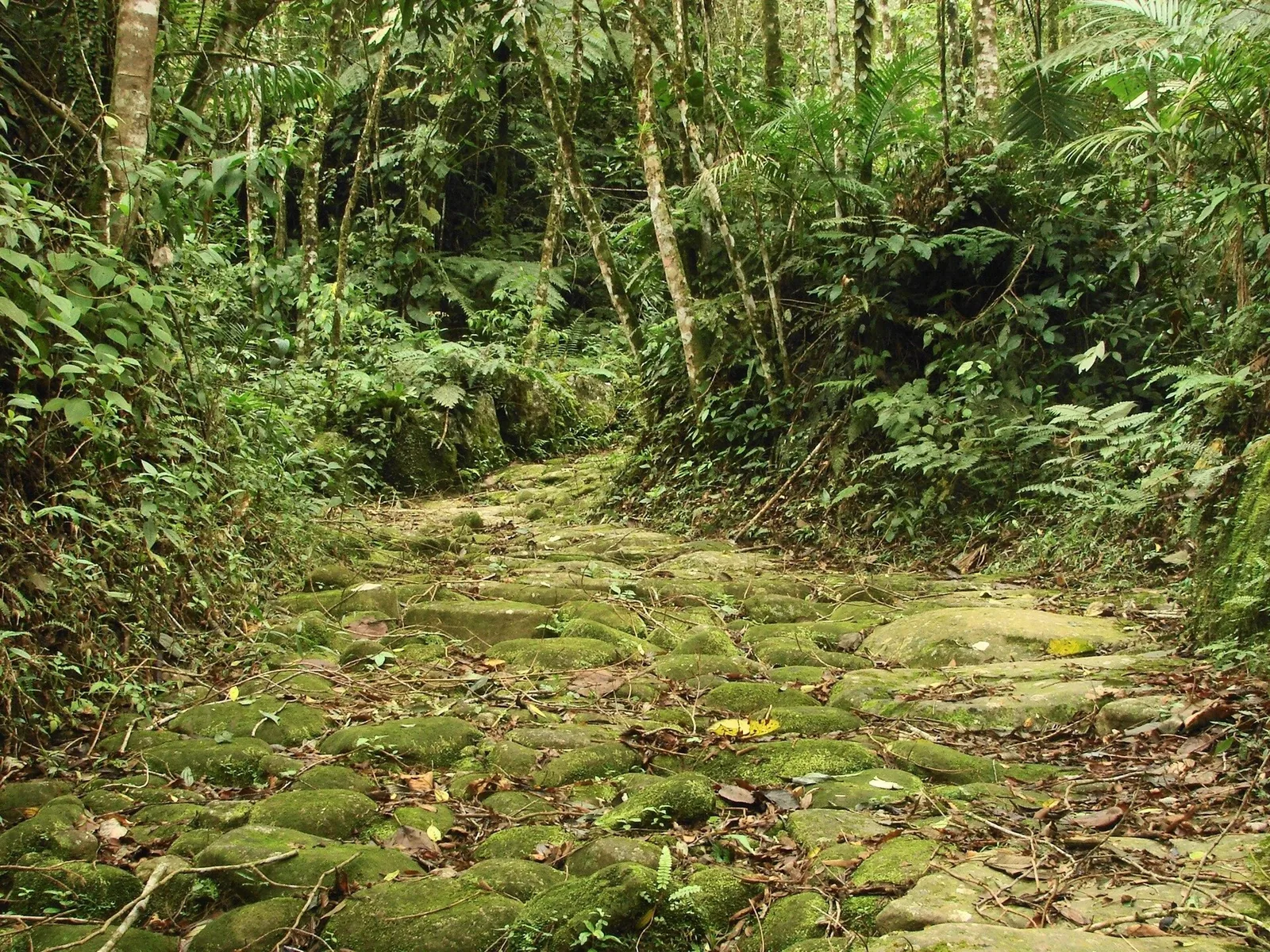
The physical link between the mines and the sea was the Caminho do Ouro, the Gold Trail, and it is the single most important object in this whole story because it is the reason Paraty existed as a port at all. In its fullest extent the network of royal roads, later called the Estrada Real, ran for well over a thousand kilometres, threading from the diamond town of Diamantina and the gold capital of Ouro Preto, through Tiradentes and São João del-Rei, and over the Serra to the coast at Paraty.
The road did not spring from nothing. Its steepest coastal stretches followed footpaths first worn by the Guaianá, and it was cut and paved into a mule road by the labour of enslaved Africans, who fitted the large stones that kept the trains from sliding in the rain. Some of those stretches survive almost untouched, climbing through Atlantic forest in exactly the form the mule drivers knew. You can walk a restored section in the hills directly behind town, and it is the best way there is to feel the weight of this history in your legs; we have set out the route and the practicalities in our guide to the Caminho do Ouro, the Gold Trail.
What went up the mountain
It is easy to picture the gold coming down and forget that the road ran both ways, and that the upward traffic tells you as much about the port. Up the mountain went the things the mining district could not produce for itself: salt, tools, iron, textiles, manioc flour to feed the miners, and the enslaved Africans landed at the coast and marched inland to work and die in the diggings. The port of Paraty was an entry point for human beings sold into the mines as much as an exit point for the metal they were forced to extract, and no honest account of the town's wealth can leave that out.
Up the mountain, too, went cachaça, the sugarcane spirit that the valleys around Paraty distilled in quantity. It fuelled the mining camps and became, in time, the town's own signature, outlasting the gold that first created a market for it. That is a thread we will pick up again, and one you can follow in person among the family cachaça distilleries that still work the hills.
A boomtown of the Portuguese Crown
For roughly the first three quarters of the eighteenth century, Paraty lived its golden century. The port handled a constant traffic of gold and, later, diamonds heading out, and supplies and enslaved people coming in. Merchants grew rich handling the trade, and money, as it always does, left its handwriting on the town. The thick-walled houses of the historic centre, the density of fine churches for so small a place, the sheer solidity of the stonework, all of it dates from the wealth that moved through the harbour in these decades.
The town became a genuine instrument of the Crown, garrisoned and administered, its comings and goings watched by royal officials. Ships arrived to carry the taxed gold on to Rio de Janeiro, from where the great fleets ran to Lisbon, and returned with the manufactured goods of Europe. For a place you can now walk across in twenty minutes, Paraty in its prime was a surprisingly cosmopolitan node in a global system, connected by sea to Rio, Lisbon and the wider Atlantic, and by the mountain road to the mines that made it all worthwhile.
The churches and the social order they mapped
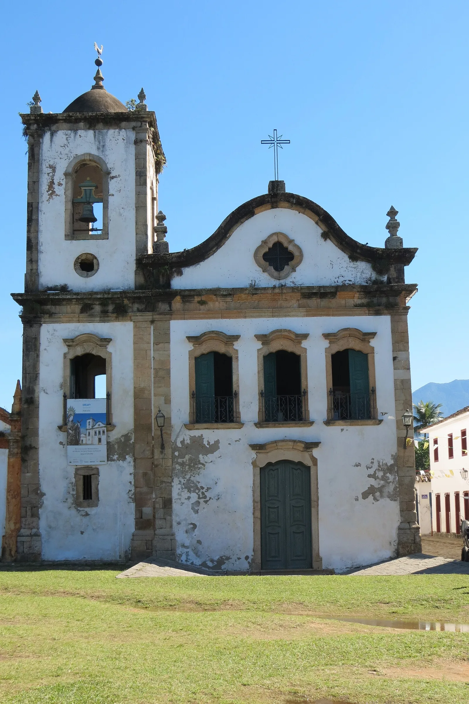
Nowhere is the wealth, and the cruelty, of the gold years written more clearly than in the town's churches, of which there are four principal survivors, each built for a different rung of colonial society. The oldest, the Igreja de Santa Rita, was raised in 1722 almost on the waterline, its restrained baroque front facing the boats; it now holds a museum of sacred art and remains the building everyone photographs first. The grand Matriz de Nossa Senhora dos Remédios anchors the main square and served the white merchant and official class.
The other two tell the harder half of the story. The Igreja de Nossa Senhora do Rosário e São Benedito was the church of the town's Black population, enslaved and freed, built and used by those whose labour underwrote everything else. The Igreja de Nossa Senhora das Dores served the white women of the elite. Four churches, four compartments of a stratified society, all standing within a few minutes of one another. To read them in sequence is to read the social machinery of a colonial port laid out in stone, and we walk that route in our guide to the historic centre of Paraty.

The tide-washed streets: engineering, not decoration
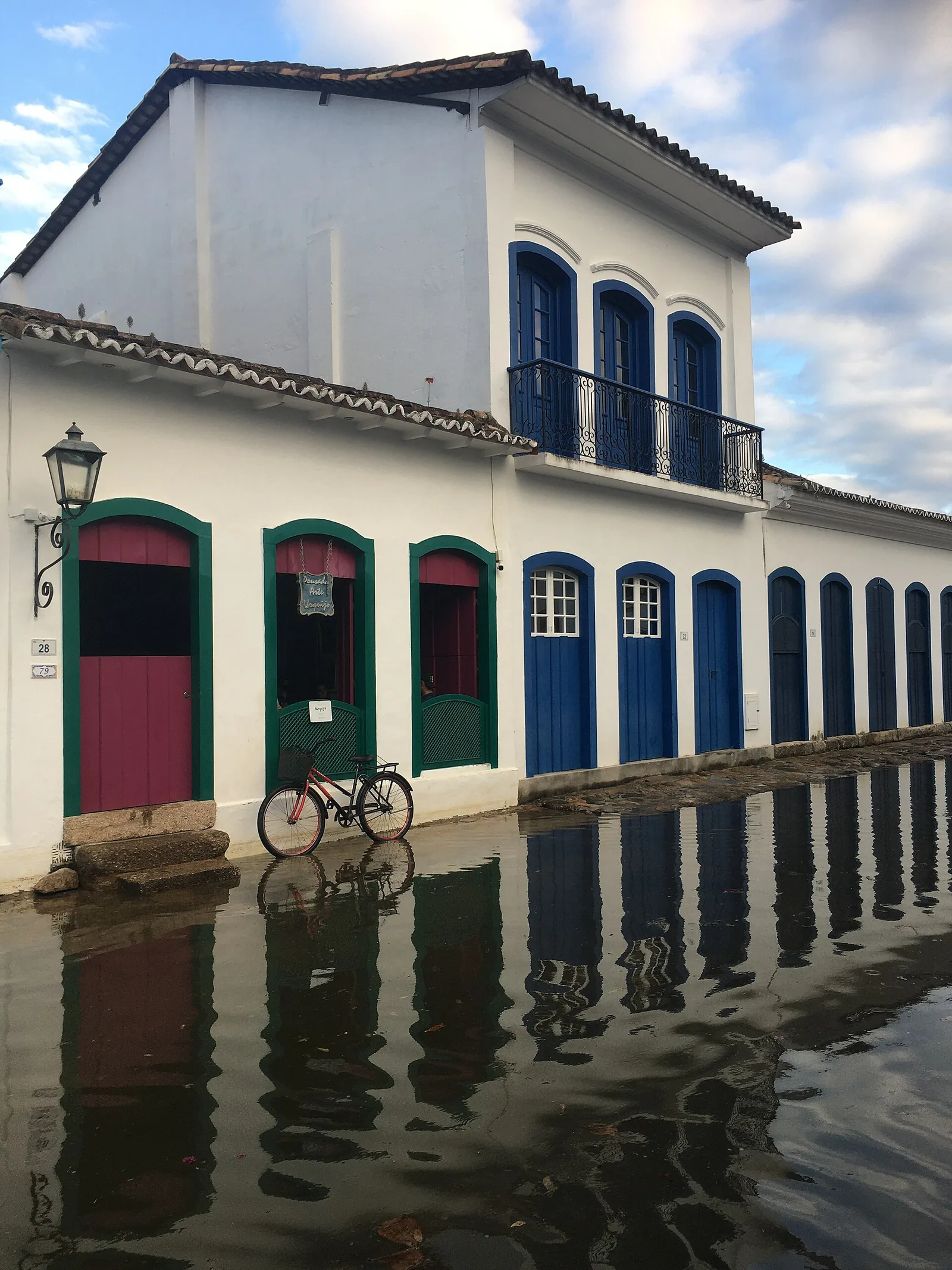
Visitors often take Paraty's most famous quirk for picturesque decay, and it is the opposite: a piece of deliberate colonial engineering. The streets of the historic centre are paved with large, rounded, purposely uneven stones, laid on a gentle slope toward the bay. At the highest spring tides, especially around the full and new moon, the sea flows up through the streets, spreads a thin sheet of water across the lanes, and then drains back out as the tide falls, carrying the day's dirt with it. The town, in effect, flushes itself.
The water is usually only ankle-deep, and the reflections of the white façades in the flooded lanes are among the loveliest things you will see in Brazil. Practically, it means two things for a visitor: check a tide table if you want to photograph either the dry cobbles or the flooded mirror, and wear shoes with a real sole, because the stones are genuinely ankle-turning and slick when wet. Knowing why the streets flood turns an inconvenience into one of the most intelligent things about the place. This was a town built to work, and the working is still visible three centuries on. For more on how the seasons and tides shape a visit, our note on the best time to visit Paraty is the place to start.
Why Paraty fell: the new road, the pirates and the empty seams
Golden centuries do not last, and Paraty's ended not with one blow but with three, arriving close enough together to be fatal. The town that had risen because it was the way to the sea fell when it stopped being the way to the sea.
The Caminho Novo
The first and deepest cause was a new road. Carrying gold by sea from Paraty around the coast to Rio de Janeiro was slow and, as we will see, dangerous, and the Crown had long wanted a more direct overland link between the mines and its principal southern port. Through the early eighteenth century a new route, the Caminho Novo, was cut to run from Minas Gerais straight down to Rio de Janeiro, cutting out the long detour to Paraty and the coastal sea leg altogether. As traffic shifted onto this shorter, safer road, the whole reason for Paraty's existence as a gold port drained away. Rio, not Paraty, became the great funnel for the wealth of the interior, and it has been the dominant city of the region ever since.
Pirates in the bay
The second cause helped drive the first. The waters between Paraty and Rio are a maze of islands, coves and channels around the Bay of Angra dos Reis, magnificent to sail today and, in the eighteenth century, ideal cover for pirates. Ships heavy with taxed gold made rich targets, and raids on them were a constant hazard of the sea route. The danger was one of the arguments for building the safer overland Caminho Novo in the first place, and every successful raid made the case stronger. You can still cross those same island-strewn waters, now entirely peacefully, on the boat trips we describe in our guide to the Angra dos Reis coast.
The seams run dry
The third cause needed no help from roads or pirates: the gold simply began to run out. The alluvial deposits that had been so easy to work were exhausted, and by the closing decades of the eighteenth century the flood of metal had slowed to a trickle. With the trade rerouted through Rio and the mines themselves fading, Paraty lost its purpose. The busy port fell quiet, the merchants drifted away, and the town began a long descent into obscurity that would, paradoxically, become its salvation.

Coffee and cachaça: the second and third lives
A town does not vanish the moment its first fortune fails, and Paraty spent the nineteenth century trying, with mixed success, to reinvent itself. Two crops carried it: coffee and sugarcane.
In the early nineteenth century, coffee planting spread through the valley of the Paraíba do Sul river inland from the coast, and for a time Paraty found a second role as an outlet for it, its harbour once again loading a valuable crop for shipment to Rio. It was a genuine revival, and some of the wealth of these decades is folded into the town as surely as the gold money before it. But it did not last either. When a railway was pushed through the Paraíba valley later in the century, it offered planters a cheaper, faster route to the port of Rio de Janeiro, and the coffee, like the gold before it, abandoned the mountain and the sea road to Paraty. The town was passed over a second time by the logic of transport that had made and then unmade it.
The cachaça town
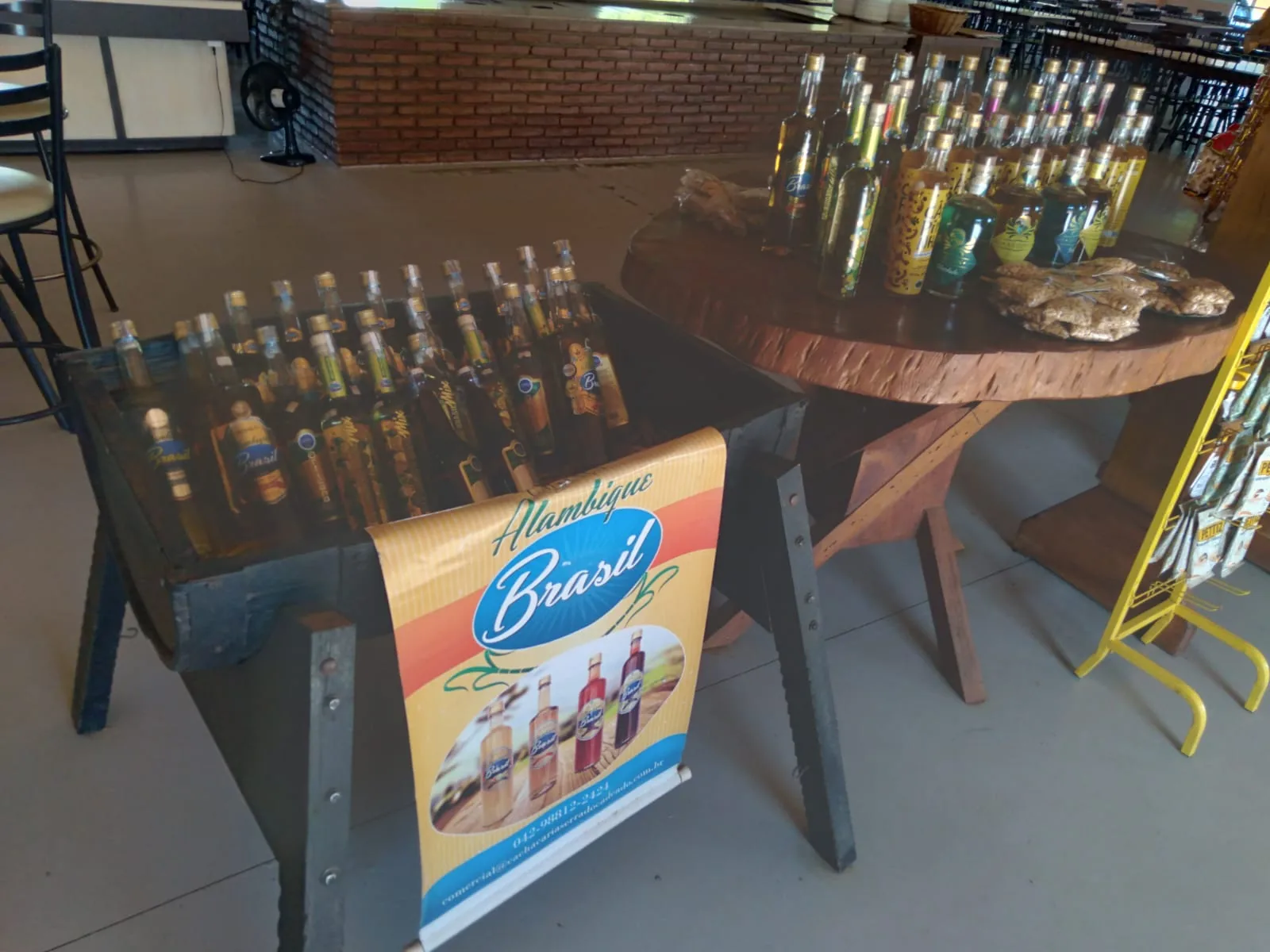
The more durable of the two crops was sugarcane, and specifically what was distilled from it. Paraty had been making cachaça, the clear sugarcane spirit, since the earliest days, supplying the mining camps up the gold road, and when the grander trades failed, the stills kept working. By the early nineteenth century more than a hundred and fifty distilleries, or alambiques, were operating in the region, and Paraty's name became so bound up with the spirit that in parts of Brazil a good cachaça was simply called a paraty.
This was more than a local industry; it was a form of survival, and it left a culture that outlived every boom. The Crown at times viewed colonial spirit with suspicion, taxing and restricting it to protect Portuguese wine and brandy, which only wove cachaça more deeply into the region's sense of itself. Today that heritage is one of the real pleasures of a visit, from the family stills in the hills to the annual cachaça festival in the town, and we trace the whole story in our journal piece on cachaça and caipirinha culture. It is a rare example of an industry that began as a footnote to gold and ended up outlasting it entirely.
The long sleep
From the late nineteenth century until well into the twentieth, Paraty did something almost no town gets the chance to do: nearly nothing. Bypassed by the gold road, then by the railway, cut off from Rio by mountains and from São Paulo by forest, it had no easy land connection to anywhere. The population shrank. There was no money to knock down the old houses and build fashionable new ones, and no pressure to. The town was, in the most literal sense, left behind.
This is the crucial, counterintuitive turn in the whole story. Paraty was not saved by anyone. It was forgotten, and being forgotten turned out to be the most complete form of preservation a town can have. While Rio and São Paulo tore themselves down and rebuilt every generation, Paraty stayed exactly as the gold and cachaça years had left it, because poverty and isolation removed every incentive to change. The eighteenth-century streets survived not despite the town's decline but because of it. By the time the outside world came looking again, there was almost nothing to restore and nothing to undo. The town had preserved itself by accident, in its sleep.

Rediscovery: the road back in the 1970s
What ended the long sleep was, fittingly, the same thing that had begun it: a road. In the middle of the twentieth century Paraty was still reachable mainly by sea and by rough mountain tracks. Then, in the 1970s, a paved coastal highway was completed linking Rio de Janeiro with Santos, on the São Paulo coast, and it ran straight past Paraty. For the first time in generations the town was easy to reach by car from both of Brazil's great cities.
What travellers found when they arrived was extraordinary: a complete colonial port that had barely changed since the eighteenth century, its churches, streets and merchant houses intact, its bay ringed by forest and islands. Word spread. Artists and writers came first, then holidaymakers from Rio and São Paulo, then visitors from abroad. The town that transport had abandoned twice was now made by transport a third time, and this time the trade it drew was tourism. For anyone driving in today, the same coastal road remains the main artery from either city, and our overview of exploring Paraty gathers the practical threads of a first visit in one place.
The rediscovery brought its own institutions. Since 2003 the town has hosted FLIP, the Festa Literária Internacional de Paraty, which turns the colonial churches and squares into one of the most important literary festivals in the Portuguese-speaking world each year. Alongside it the older calendar of religious tradition endures, above all the Festa do Divino Espírito Santo around Pentecost, with its processions and folk music. These are not spectacles staged for outsiders; they are the town's own life, now shared. We write about the rhythm of the year in our guide to FLIP and the festivals of Paraty.
Heritage recognised: from national monument to UNESCO
Formal recognition followed the rediscovery. Brazil's national heritage institute had already moved to protect the historic centre in the mid-twentieth century, listing the town and declaring it a national monument, which shielded the colonial core from unsympathetic development just as the tourists began to arrive. That early protection is a large part of why the centre remains so coherent: it was legally frozen before anyone could spoil it.
The great recognition came in 2019, when UNESCO inscribed the property it calls Paraty and Ilha Grande, Culture and Biodiversity, on the World Heritage List. What matters is the form of the listing. It is a mixed site, honoured for its cultural and its natural value at the same time, and it was the first mixed site in all of Brazil. UNESCO did not treat the white churches as separate from the green mountains and the blue bay. It recognised them as a single landscape, because historically they were one: the forest the gold road climbed, the harbour the gold left from, and the town the gold built.
The inscribed area is what specialists call a serial property, several components rather than one line on a map, taking in the historic centre and a dramatic coastal headland together with a sweep of protected nature, from the Serra da Bocaina heights down through the Cairuçu area to the state park on Ilha Grande and a biological reserve on its outer shore. For a visitor this has a lovely consequence. The World Heritage Site is not a monument you queue to enter. It is the whole world around you for days at a time, the streets you walk, the bay you sail, the forest you climb, and the island you reach on a day trip to Ilha Grande. You live inside the listing the entire time you are here.
Walking the gold history today
The great pleasure of Paraty is that its history is not shut in a museum; it is underfoot and all around, and you can trace the whole arc of this story in a couple of unhurried days. A natural sequence goes something like this.
- Start on the water. Look at the town from the seawall or, better, from a boat in the bay, and understand it as a port first. From offshore the logic of the place is obvious: the sheltered harbour, the mountains behind, the islands screening the approach. This is what the gold ships saw.
- Walk the four churches. Move through the historic centre reading the churches in social order, from the merchants' Matriz to the Igreja de Nossa Senhora do Rosário e São Benedito built by and for the town's Black population. This is the gold century's wealth and cruelty in one short walk.
- Climb the Caminho do Ouro. Take a restored stretch of the gold road up into the forest behind town. Standing on the fitted stones, laid by enslaved hands three hundred years ago, with the bay glittering far below, is the moment the whole story becomes physical rather than abstract.
- Visit a working still. Finish among the alambiques in the valleys, where the cachaça that outlived the gold is still made. It is the through-line of the entire history, the one trade that survived every boom and bust.
Time your walking around the tides and the heat: mornings for the churches, when the eastern light fills them and the day is cool, and an eye on the tide table if you want either the dry cobbles or the flooded, mirror-still lanes. None of this needs to be rushed, and Paraty punishes rushing. The town rewards the same slowness it was accidentally granted during its long sleep.
Reading the history honestly: the labour beneath the gold
It would be a kind of dishonesty to tell this as a simple tale of rise and fall and pretty streets, and the town itself increasingly refuses to let you. Every element of the wealth in this story, the gold and the diamonds, the churches and the merchant houses, the paved gold road and the cobbled lanes, rested on the labour of enslaved Africans and their Brazilian-born descendants. They were marched up the mountain through this very port to work the mines. They cut and laid the stones of the Caminho do Ouro. They built the churches, including the one set aside for their own worship. Brazil received more enslaved people than any other country in the Americas, and Paraty, as a port of the gold trade, was a link in that chain.
The encouraging thing is that this history is no longer hidden here. The Igreja de Nossa Senhora do Rosário e São Benedito stands as the church of the town's Black community and is the right place to begin thinking about it. The living traditions of the region, its music, its festivals of African-rooted Catholicism, its very cuisine, carry that heritage forward. To walk Paraty well is to hold two things at once: real admiration for what was built, and a clear sight of who built it and at what cost. The town is richer for being seen whole, and so is the visit. This wider colonial story, and how Paraty fits within it, is something we explore in our journal essay on Brazil's colonial towns.
A base above the bay the gold crossed
There is a particular pleasure in reading this history from a height. The chalet sits roughly four hundred metres above the Bay of Paraty, and from the terrace and the infinity pool the whole geography of the story lays itself out at once: the historic town below, the sheltered harbour the gold left from, the maze of islands toward Angra dos Reis where the pirates waited, and the wall of the Serra behind, up which the gold road climbed. It is one of the few places where you can take in Paraty, Angra dos Reis and Ilha Grande in a single sweep of the eye, the three points of the whole eighteenth-century drama held in one view.
It also makes a genuinely comfortable base for the kind of slow, layered visit this history deserves. You can spend a morning among the white churches, an afternoon on a restored stretch of the Caminho do Ouro, an evening on the water, and come back each time to a swim and a quiet terrace above it all. There is something fitting about resting on a hillside the gold itself once crossed. You can see the layout, the views and the practicalities on the page for the chalet.
If this is the sort of trip that draws you, a few unhurried days spent reading a small town's enormous history in its streets and stones, that is exactly the kind of visit we most enjoy helping to shape, from the order of the days to the timing of the tides. Tell us what moves you about the story, the gold road, the churches, the cachaça, the long forgetting, and we will help you build a stay around it. You will find a real person to answer on the contact page. Paraty waited, forgotten, for a very long time. It is a fine thing to arrive as unhurried as the town itself.

Frequently asked questions
From the 1690s, gold discovered in the mountains of Minas Gerais was carried by mule down the Caminho do Ouro to Paraty, the nearest sheltered port, and shipped from there to Rio de Janeiro and on to Portugal. For roughly a century Paraty was one of colonial Brazil's most important ports, until the gold ran out and a more direct road to Rio drew the trade away in the late eighteenth century.
Three things ended Paraty's golden century at once. Pirates preying on the gold ships in the island-strewn waters near Angra dos Reis made the sea route dangerous; the Crown opened a safer, more direct overland road, the Caminho Novo, from Minas straight to Rio de Janeiro, bypassing the port; and the gold itself began to run out in the late 1700s. The town slid into a long, quiet obscurity.
The Caminho do Ouro, or Gold Trail, was the stone-paved colonial road that carried gold and diamonds down from the mines of Minas Gerais to the port of Paraty. Part of the wider network of royal roads known as the Estrada Real, it was cut and paved by enslaved labourers along tracks first made by the Guaianá people, and restored sections can still be walked in the hills behind the town.
Yes. In 2019 UNESCO inscribed 'Paraty and Ilha Grande – Culture and Biodiversity', a mixed cultural and natural site and the first of its kind in Brazil. The listing recognises the colonial town together with the surrounding Atlantic Forest, mountains and islands as a single landscape rather than protecting the streets alone.
The town's rebirth came with a road. When a paved coastal highway linking Rio de Janeiro and Santos was completed in the 1970s, Paraty was suddenly reachable by car for the first time in generations. Travellers found a colonial town that had barely changed in two centuries, and tourism, festivals such as FLIP, and eventually UNESCO recognition followed.
After the gold declined, Paraty built a second economy on cachaça, the sugarcane spirit distilled in the surrounding valleys; by the early nineteenth century more than a hundred and fifty stills were working in the region. It later served as a coffee port, and today it is known for its intact colonial centre, its bay and islands, the Caminho do Ouro, and the FLIP literary festival held each year.
It is by design, not accident. The historic centre was laid on a slope with large, deliberately uneven cobbles so that the highest spring tides flow up through the streets, wash them clean and then drain back to the bay. The water is usually only ankle-deep, and the reflections of the white walls in the standing water are one of the town's quiet pleasures.